


;Resize=805#)


Tracking air pollution from space – Airbus

Report on Advancements in Air Quality Monitoring and Alignment with Sustainable Development Goals
This report details the critical role of new European space capabilities in enhancing air quality monitoring, with a specific focus on their contribution to achieving the United Nations Sustainable Development Goals (SDGs). The launch of next-generation satellites in 2025, including advanced Copernicus Sentinels and EUMETSAT’s MetOp-SG A, marks a significant advancement in providing high-quality, timely, and reliable data essential for sustainable development.
The Imperative for Air Quality Monitoring: A Health and Environmental Perspective
Impact on SDG 3: Good Health and Well-being
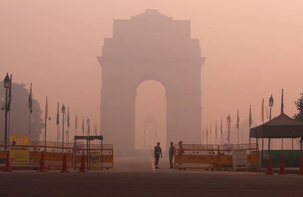
Air quality is intrinsically linked to public health. The World Health Organization identifies air pollution as the most significant environmental health risk, directly undermining the achievement of SDG 3. Specifically, it poses a major obstacle to Target 3.9, which aims to substantially reduce deaths and illnesses from hazardous air pollution.
- Globally, air pollution is attributed to approximately seven million premature deaths annually.
- In Europe alone, the figure approaches 600,000 premature deaths each year.
- Chronic exposure to harmful gases and microscopic particles, inhaled daily, leads to severe respiratory and cardiovascular diseases.
Relevance to SDG 11, SDG 13, and SDG 15
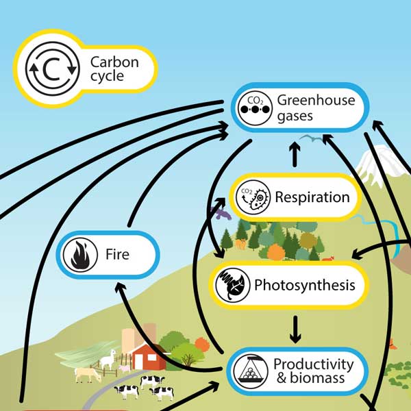
The sources of air pollution are directly related to key challenges addressed by other SDGs. Monitoring these pollutants is vital for creating sustainable urban environments, combating climate change, and protecting terrestrial ecosystems.
- SDG 11 (Sustainable Cities and Communities): Major pollution sources, such as fossil fuel combustion, road traffic, and industrial emissions, are concentrated in urban areas. Improved monitoring supports Target 11.6, which focuses on reducing the adverse environmental impact of cities by improving air quality.
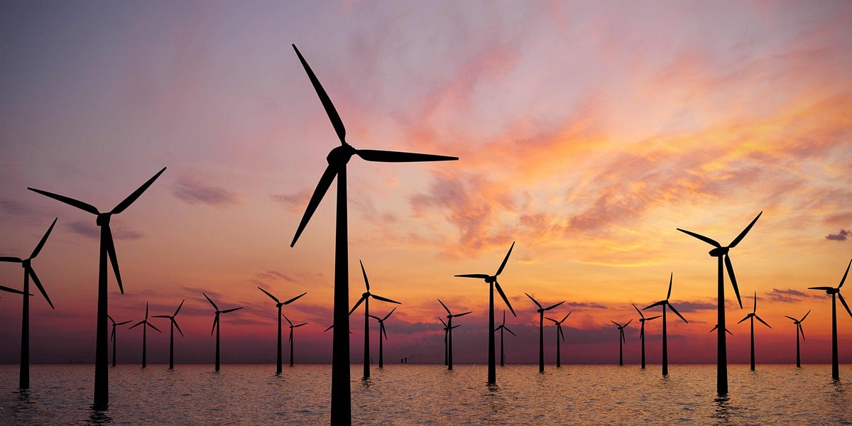
- SDG 13 (Climate Action): The same emissions driving poor air quality are also primary contributors to climate change. Accurate atmospheric data is crucial for refining climate models and developing effective mitigation and adaptation strategies, supporting Targets 13.1 and 13.3.
- SDG 15 (Life on Land): Natural events like wildfires and Saharan dust storms, which degrade air quality, also impact ecosystems. Monitoring helps in understanding and mitigating these effects on vegetation and land, aligning with Targets 15.1 and 15.3.
Current Monitoring Frameworks and Methodologies
The Copernicus Atmosphere Monitoring Service (CAMS)
The Copernicus Atmosphere Monitoring Service (CAMS), operated by the European Centre for Medium-Range Weather Forecasts (ECMWF), provides essential information to support SDG-related policy. The service addresses the challenge of monitoring pollutants that are rapidly transformed and transported by atmospheric conditions.
- Predictive Modelling: CAMS utilizes advanced models that simulate chemical reactions, wind transport, and the influence of meteorological parameters like sunlight and temperature.
- Data Assimilation: To ensure accuracy, the models are continuously adjusted. Every twelve hours, real-time satellite measurements are incorporated to compare against previous forecasts.
- Forecasting: The model state is updated with this new data, initiating a new and more accurate forecast for up to five days, providing a reliable picture of air quality for policymakers and the public.
Existing Space-Based Assets Supporting SDG Targets
CAMS currently leverages data from several satellites to track pollutants and inform responses, contributing directly to SDG monitoring.
- Sentinel-5P: Provides crucial observations of ozone, nitrogen dioxide, carbon monoxide, and sulphur dioxide, which are key indicators for SDG 3 and SDG 11.
- Sentinel-3: Delivers data on aerosol optical depth, enabling the tracking of pollutants from fires. This information is vital for assessing impacts on health (SDG 3), climate (SDG 13), and terrestrial ecosystems (SDG 15).
A notable application was the tracking of smoke plumes from intense Canadian forest fires in 2025, which spread across the Atlantic to Europe. CAMS provided critical forecasts, demonstrating its capacity for early warning, a key component of SDG 13.3.
Next-Generation Satellites: Enhancing Data for Sustainable Development
The upcoming generation of European satellites will significantly enhance data availability, directly supporting SDG 17 (Partnerships for the Goals), particularly Target 17.18, which calls for increasing the availability of high-quality, timely, and reliable data.
Advanced Instruments and Capabilities
- Sentinel-4: Launched in 2025, this instrument will provide unprecedented hourly, high-resolution data on pollutants over Europe. This leap from one daily image to hourly observations will enable precise modelling of diurnal pollution cycles, empowering cities to better manage air quality (SDG 11) and issue timely public health warnings (SDG 3).
- MetOp-SG A: This satellite will carry two powerful instruments built by Airbus.
- The Infrared Atmospheric Sounding Interferometer (IASI-NG) will monitor ammonia, a significant pollutant affecting both human health and ecosystems (SDG 3, SDG 15).
- The Sentinel-5 spectrometer will provide daily global measurements of a wide array of trace gases and aerosols, complementing Sentinel-4 and strengthening the global dataset for climate and pollution research (SDG 13).
Applications for Policy, Research, and Public Engagement
The enhanced data streams will serve as indispensable tools for a wide range of stakeholders committed to the SDGs.
- Policy and Governance: Governments can use the data to implement effective air quality strategies and alert populations when pollution exceeds health thresholds, directly contributing to SDG 3 and SDG 11.
- Scientific Research: Scientists can utilize the high-resolution data to refine climate and atmospheric models, advancing our understanding of Earth systems in line with SDG 13.
- Public Awareness: Data is integrated into accessible platforms, such as the Windy smartphone application, empowering citizens with information on major pollutants. This fosters public engagement and awareness, a key aspect of SDG 13.3.
In conclusion, the new generation of European satellites represents a coordinated, multi-stakeholder effort (SDG 17) to leverage technology for the global good. By providing more frequent, higher-resolution data, these missions will deepen our understanding of atmospheric processes and provide the actionable intelligence needed to advance the Sustainable Development Goals for a healthier and more sustainable future.
Analysis of Sustainable Development Goals in the Article
1. Which SDGs are addressed or connected to the issues highlighted in the article?
The article on air quality monitoring and new satellite technology addresses several Sustainable Development Goals (SDGs) by focusing on the environmental, health, and technological aspects of air pollution.
- SDG 3: Good Health and Well-being: The article directly links air pollution to severe health impacts, citing the World Health Organization’s data on premature deaths caused by ambient and household air pollution.
- SDG 9: Industry, Innovation, and Infrastructure: The core of the article is about technological advancement and innovation. It details the launch of new European space capabilities, including advanced satellites (MetOp-SG A, Sentinel-4) and instruments (IASI-NG, Sentinel-5 spectrometer), which represent a significant upgrade in infrastructure for scientific research and data collection.
- SDG 11: Sustainable Cities and Communities: The article discusses pollutants originating from urban and industrial activities, such as “road traffic, and industrial emissions.” The monitoring and forecasting of air quality are crucial for managing the environmental impact of cities and protecting urban populations.
- SDG 13: Climate Action: Air pollution and climate change are closely linked, as many pollutants (e.g., from burning fossil fuels) are also greenhouse gases. The article mentions that the data helps scientists “in refining climate models” and is used to track climate-related hazards like “wildfires.”
- SDG 15: Life on Land: The article notes that air pollution, specifically ground-level ozone, can “damage… vegetation” and that pollutants “impact ecosystems,” connecting the issue to the health of terrestrial ecosystems.
- SDG 17: Partnerships for the Goals: The entire initiative described is a result of collaboration between multiple entities, including Copernicus, EUMETSAT, and Airbus. The article also highlights the goal of making data “free-to-use information for policymakers, environmental agencies and citizens around the world,” which promotes global partnerships and data sharing.
2. What specific targets under those SDGs can be identified based on the article’s content?
Based on the issues discussed, the following specific SDG targets are relevant:
-
Target 3.9: By 2030, substantially reduce the number of deaths and illnesses from hazardous chemicals and air, water and soil pollution and contamination.
- The article’s central theme is the health risk of air pollution, stating it is “responsible for nearly 600,000 premature deaths each year in Europe, and approximately seven million globally.” The monitoring efforts are aimed at mitigating this risk.
-
Target 11.6: By 2030, reduce the adverse per capita environmental impact of cities, including by paying special attention to air quality.
- The article focuses on monitoring pollutants from “road traffic, and industrial emissions,” which are primary sources of urban air pollution. The data provided by CAMS enables governments to “alert the population when pollution levels exceed regulatory limits” in populated areas.
-
Target 9.5: Enhance scientific research, upgrade the technological capabilities of industrial sectors in all countries… encouraging innovation.
- The article describes the “launch of new European space capabilities,” including “advanced Copernicus Sentinels” and “next generation of weather satellites.” This represents a direct upgrade of technological capabilities for scientific research and monitoring.
-
Target 13.1: Strengthen resilience and adaptive capacity to climate-related hazards and natural disasters in all countries.
- The article provides an example of CAMS tracking and forecasting smoke plumes from “intense forest fires,” which are a climate-related hazard. This technology enhances early warning systems and resilience.
-
Target 17.18: By 2020, enhance capacity-building support… to increase significantly the availability of high-quality, timely and reliable data.
- The Copernicus Atmosphere Monitoring Service (CAMS) is described as transforming “satellite observations into useful and free-to-use information for policymakers, environmental agencies and citizens around the world,” directly contributing to the availability of timely and reliable data. The move from daily to “hourly observations” further enhances this.
3. Are there any indicators mentioned or implied in the article that can be used to measure progress towards the identified targets?
The article mentions or implies several indicators that align with the official SDG indicator framework.
-
Indicator 3.9.1: Mortality rate attributed to household and ambient air pollution.
- The article explicitly provides this data: “air pollution is responsible for nearly 600,000 premature deaths each year in Europe, and approximately seven million globally.”
-
Indicator 11.6.2: Annual mean levels of fine particulate matter (e.g. PM2.5 and PM10) in cities (population weighted).
- The article details the monitoring of key pollutants that constitute this indicator, including “microscopic particles,” “nitrogen dioxide,” “carbon monoxide,” “sulphur dioxide,” “aerosols,” and “fine particulate matter.” The CAMS service is designed to measure and forecast the concentration of these pollutants.
-
Qualitative evidence for Indicator 9.5.1 (Research and development expenditure):
- While not providing financial figures, the article offers strong qualitative evidence of investment in R&D and technological upgrades. It describes the advanced capabilities of new satellites like Sentinel-4, which will provide “unprecedented hourly high-resolution data,” a significant improvement over previous systems.
-
Implied indicators for Target 15.1 (Conservation of ecosystems):
- The monitoring of “ground-level ozone,” which the article states can “damage… vegetation,” serves as an indirect indicator for assessing the impact of air pollution on terrestrial ecosystems.
-
Qualitative evidence for Indicator 17.18.1 (Statistical capacity indicator for Sustainable Development):
- The article describes the CAMS system, which provides “free-to-use information” and data visualizations through apps like “Windy.” This demonstrates an increased capacity for producing and disseminating timely and reliable data on air quality, a key component of sustainable development monitoring.
4. Table of SDGs, Targets, and Indicators
| SDGs | Targets | Indicators Identified in the Article |
|---|---|---|
| SDG 3: Good Health and Well-being | 3.9: Substantially reduce the number of deaths and illnesses from air pollution. | 3.9.1 (Mortality rate attributed to air pollution): The article cites figures of “600,000 premature deaths each year in Europe, and approximately seven million globally” due to air pollution. |
| SDG 11: Sustainable Cities and Communities | 11.6: Reduce the adverse per capita environmental impact of cities, paying special attention to air quality. | 11.6.2 (Annual mean levels of fine particulate matter): The article mentions monitoring of “fine particulate matter,” “nitrogen dioxide,” “ozone,” and other pollutants from sources like “road traffic, and industrial emissions.” |
| SDG 9: Industry, Innovation, and Infrastructure | 9.5: Enhance scientific research and upgrade technological capabilities. | Qualitative evidence of technological upgrades: Description of new satellites (Sentinel-4, MetOp-SG A) and instruments (IASI-NG) that enhance monitoring from daily to “hourly observations.” |
| SDG 13: Climate Action | 13.1: Strengthen resilience and adaptive capacity to climate-related hazards. | Implied indicator (Early warning systems): The CAMS system’s ability to “track and forecast the smoke plumes” from wildfires serves as a tool for disaster risk reduction. |
| SDG 15: Life on Land | 15.1 / 15.9: Ensure conservation of terrestrial ecosystems and integrate ecosystem values into planning. | Implied indicator (Ecosystem health): Monitoring of “ground-level ozone,” which is stated to “damage human respiratory systems and vegetation.” |
| SDG 17: Partnerships for the Goals | 17.18: Increase the availability of high-quality, timely, and reliable data. | Qualitative evidence of data availability: The CAMS program provides “free-to-use information for policymakers, environmental agencies and citizens” and data visualization through apps like “Windy.” |
Source: airbus.com

What is Your Reaction?
 Like
0
Like
0
 Dislike
0
Dislike
0
 Love
0
Love
0
 Funny
0
Funny
0
 Angry
0
Angry
0
 Sad
0
Sad
0
 Wow
0
Wow
0