


_1.png?#)


US-CoastEX: Observation-based probabilistic reanalysis of storm surge and sea level extremes for the United States – Nature
Report on a New Probabilistic Dataset for U.S. Coastal Risk Assessment and its Contribution to the Sustainable Development Goals
Executive Summary
Achieving the Sustainable Development Goals (SDGs), particularly those related to climate action, resilient infrastructure, and sustainable communities, requires accurate data on climate-related hazards. Extreme sea level (ESL) events and storm surges pose a significant threat to coastal populations, economies, and ecosystems, directly challenging the progress of several SDGs. A new, fully observation-driven probabilistic dataset, US-CoastEX (1950–2020), has been developed to address critical data scarcity along U.S. coastlines. By employing advanced Bayesian statistical methods and integrating data sources often overlooked, this dataset provides more reliable estimates of storm surge and sea level extremes. The findings reveal that traditional methods have underestimated 100-year extreme sea levels by an average of 50% in many regions. This report outlines the methodology and findings of this research, emphasizing its critical role in providing the evidence base needed to advance SDG 9 (Industry, Innovation, and Infrastructure), SDG 11 (Sustainable Cities and Communities), and SDG 13 (Climate Action).
1. Introduction: The Imperative for Resilient Infrastructure and Climate Action (SDGs 9, 11, 13)
1.1 The Challenge of Extreme Sea Levels in the Context of Sustainable Development
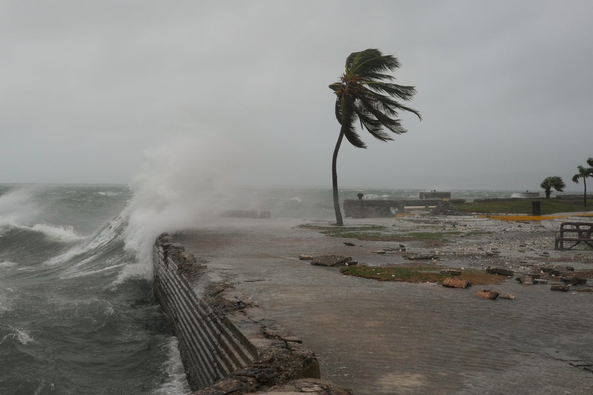
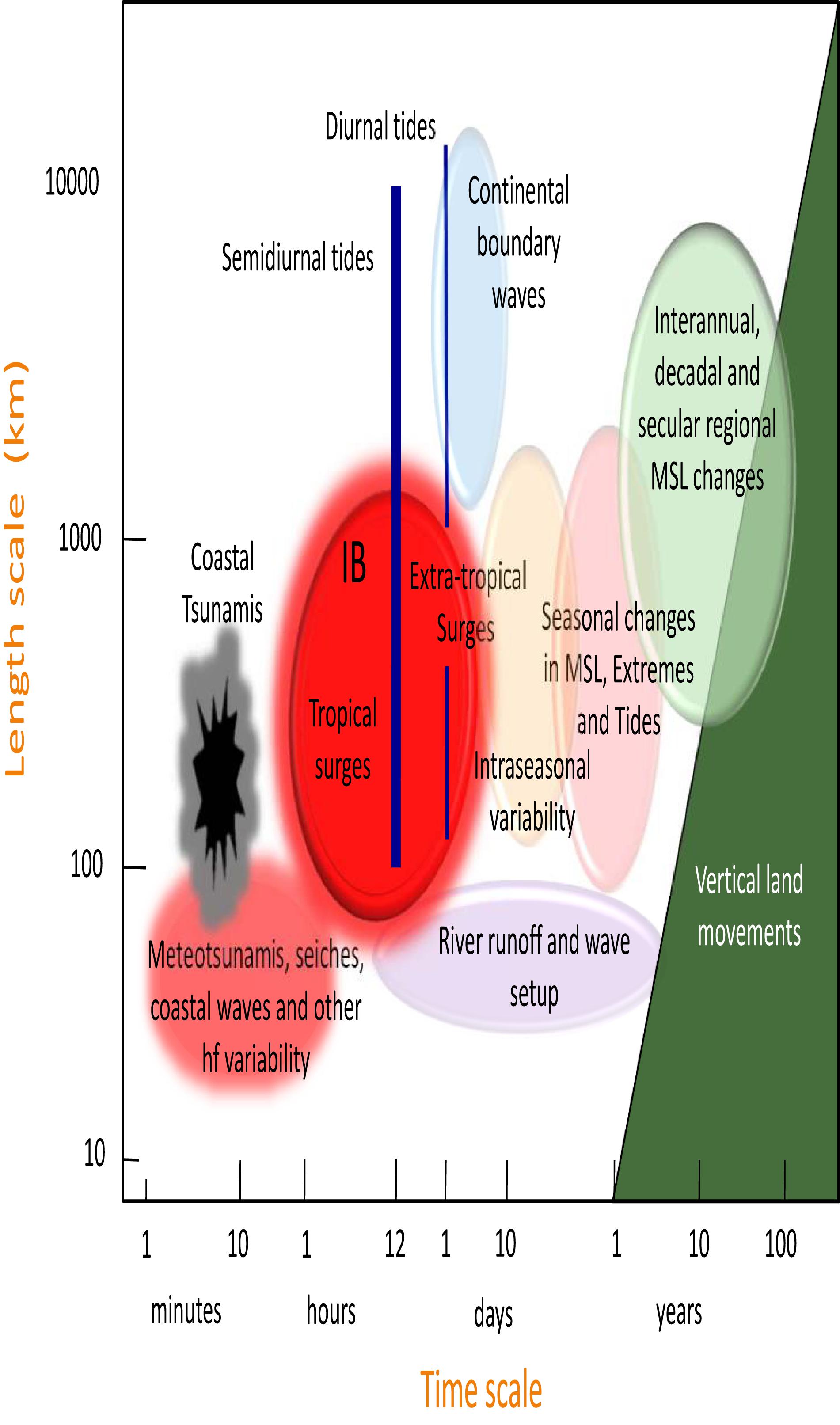
Extreme sea level (ESL) events, driven by storm surges from hurricanes and extratropical storms, represent a primary climate-related hazard. These events threaten the safety and sustainability of coastal regions, which are critical hubs of population and economic activity. This directly impacts several Sustainable Development Goals:
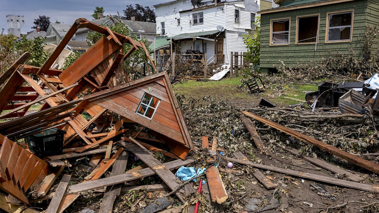
- SDG 11 (Sustainable Cities and Communities): Coastal flooding endangers lives, displaces communities, and damages critical urban infrastructure, undermining the goal of making human settlements safe, resilient, and sustainable (Target 11.5).
- SDG 13 (Climate Action): The increasing frequency and intensity of extreme weather events necessitate robust adaptation strategies. Accurate risk assessment is fundamental to strengthening resilience and adaptive capacity to climate-related hazards (Target 13.1).
- SDG 9 (Industry, Innovation, and Infrastructure): Reliable and resilient infrastructure is the backbone of economic development. Coastal infrastructure, including ports, energy facilities, and transportation networks, is highly vulnerable to ESLs, and its failure can have cascading economic consequences (Target 9.1).
1.2 Data Scarcity as a Barrier to Achieving the SDGs
A significant barrier to effective coastal adaptation and planning has been the lack of reliable, high-resolution data on sea level extremes. Key limitations of existing data sources include:
- Geographic Gaps: Tide gauges provide high-quality data but are sparsely located, leaving vast stretches of coastline unmonitored. This is particularly true for vulnerable regions like Alaska, Hawaii, and Puerto Rico, exacerbating inequalities in risk management (linking to SDG 10).
- Incomplete Records: Many tide gauge records are short or contain gaps, especially during major storms when equipment fails. This leads to an under-sampling of the most extreme, high-impact events.
- Model Underestimation: Global and regional storm surge models, often based on coarse atmospheric reanalysis, tend to underestimate the intensity of storm surge extremes, leading to a false sense of security and inadequate infrastructure design.
These data deficiencies prevent robust flood risk assessment, leading to flawed adaptation planning and potentially catastrophic failures of coastal defenses. This undermines efforts to build resilience as mandated by the SDGs.
2. A New Observation-Driven Dataset (US-CoastEX) for Enhanced Coastal Resilience
2.1 Methodological Framework: The BAYEX Model
To overcome these challenges, the US-CoastEX dataset was developed using a non-stationary spatiotemporal Bayesian Hierarchical Framework (BAYEX). This innovative approach (contributing to SDG 9, Target 9.5 on scientific research) provides a more robust analysis of storm surge extremes. The model’s key features include:
- Spatiotemporal Modeling: BAYEX resolves spatial dependencies between tide gauge sites, allowing information to be shared across locations. This compensates for data gaps and enables reliable predictions for ungauged sites.
- Non-Stationary Analysis: The model accounts for the fact that storm surge characteristics change over time, capturing trends in extreme events that are critical for understanding climate change impacts (SDG 13).
- Rigorous Uncertainty Quantification: The Bayesian framework rigorously propagates uncertainties from the data, processes, and parameters, providing decision-makers with a clear understanding of the range of potential outcomes.
2.2 Data Integration for Comprehensive Risk Assessment
The US-CoastEX dataset was created in two versions to provide a comprehensive view of coastal risk:
- Standard Version (BAYESL-TG): This version is informed solely by high-quality hourly sea-level records from 208 open-coast tide gauges (1950-2020).
- Extended Version (BAYESL-TG/EXT): This enhanced version incorporates additional observational data that capture the true magnitude of historic storms, which are often missing from standard records. Sources include:
- Sub-hourly (6-minute) tide gauge records.
- Inferred extremes from gap-filling procedures.
- High-water marks and storm-tide peaks from databases like SURGEDAT.
This extended dataset ensures that major historical events like Hurricanes Katrina and Camille are properly represented, providing a more realistic assessment of coastal vulnerability. The dataset also includes estimates of ESL return levels, calculated by combining the storm surge data with astronomical tide data.
3. Key Findings and Implications for Sustainable Development Goals
3.1 Underestimation of Coastal Risk in Previous Models
A primary finding of this research is that traditional risk assessments have significantly underestimated the threat of coastal flooding. When compared to existing datasets from NOAA and widely used numerical models (CODEC), the US-CoastEX data reveals that 100-year ESLs have been underestimated by an average of 50% along much of the U.S. coast. For some major coastal cities, events previously considered 100-year occurrences are now estimated to be up to 20 times more likely.
3.2 Direct Contributions to SDG 13 (Climate Action)
The US-CoastEX dataset is a powerful tool for climate action. By providing a more accurate, observation-based assessment of climate-related hazards, it directly supports Target 13.1 (Strengthen resilience and adaptive capacity to climate-related hazards and natural disasters). This improved understanding is essential for developing effective, evidence-based adaptation strategies and avoiding maladaptation, where investments are made based on flawed risk assessments.
3.3 Bolstering SDG 11 (Sustainable Cities) and SDG 9 (Resilient Infrastructure)
The findings have profound implications for urban and infrastructure planning:
- For SDG 11: The data enables coastal managers to make more confident decisions to protect vulnerable communities, especially in areas with limited local monitoring. This helps significantly reduce the potential economic losses and number of people affected by water-related disasters (Target 11.5).
- For SDG 9: The dataset provides a new, more reliable benchmark for engineering design. Building resilient infrastructure (Target 9.1) that can withstand future climate impacts requires accurate estimates of extreme events. This data can prevent the premature failure of flood defenses and other critical assets.
3.4 Supporting Vulnerable Populations (SDG 1 and SDG 10)
By providing robust data for previously under-monitored regions (e.g., Hawaii, Alaska, Puerto Rico/U.S. Virgin Islands), the dataset helps address geographic inequalities in risk assessment (SDG 10). This is crucial for protecting the poor and people in vulnerable situations, who are often disproportionately affected by natural disasters, thereby contributing to building their resilience (SDG 1, Target 1.5).
4. Technical Validation and Data Records
4.1 Comparison with Existing Datasets
The technical validation of the US-CoastEX dataset involved comparisons with established sources:
- NOAA Estimates: BAYESL-TG/EXT estimates for 100-year ESLs exceed those from NOAA’s regional frequency analysis by up to 1.5 meters along the U.S. East and Gulf coasts.
- CODEC Model Hindcast: BAYESL-TG/EXT estimates exceed those from the CODEC dataset for approximately 87% of the U.S. coastline, by 65% on average.
These discrepancies highlight the significant improvements offered by the advanced statistical modeling and comprehensive data integration of US-CoastEX.
4.2 Data Availability and Considerations for Application
The complete US-CoastEX dataset is publicly archived at Zenodo, promoting open science and partnerships for the goals (SDG 17). The data is provided in NetCDF format and includes:
- Samples of non-stationary extreme skew surge distributions (GEV parameters).
- Return level estimates of extreme sea levels for various return periods.
Users should note that the dataset is designed for open-coast regions and may not be representative of extremes within deltas, narrow inlets, or tidal rivers where local geography plays a dominant role.
5. Conclusion: Advancing Evidence-Based Policy for a Sustainable Future
The US-CoastEX dataset represents a significant advancement in our ability to understand and quantify the risks of extreme sea level events. By revealing that historical risk has been substantially underestimated, this research underscores the urgency of re-evaluating coastal management and adaptation strategies. The dataset provides a critical evidence base for policymakers, engineers, and coastal managers to make informed decisions that protect lives, property, and ecosystems. In doing so, it serves as a foundational tool for advancing key Sustainable Development Goals, helping to build more resilient infrastructure (SDG 9), create safer and more sustainable coastal communities (SDG 11), and mount an effective response to the challenges of climate change (SDG 13).
SDGs, Targets, and Indicators Analysis
1. Which SDGs are addressed or connected to the issues highlighted in the article?
The article’s focus on developing a reliable dataset for storm surges and extreme sea levels to improve risk and adaptation planning connects to several Sustainable Development Goals. The primary goals identified are:
-
SDG 13: Climate Action
The article directly addresses the impacts of climate-related hazards. It focuses on understanding and predicting “storm surge extremes,” “hurricanes,” and “extreme sea levels,” which are exacerbated by climate change. The core purpose of the US-CoastEX dataset is to “strengthen resilience and adaptive capacity to climate-related hazards and natural disasters.”
-
SDG 11: Sustainable Cities and Communities
The research aims to make human settlements, particularly coastal ones, safer and more resilient. The dataset is designed to support “coastal managers to make decisions” and enable “cost-effective risk/adaptation planning” to protect “vulnerable coastal populations” from flooding and other water-related disasters.
-
SDG 9: Industry, Innovation and Infrastructure
The article presents a significant scientific innovation—the “spatiotemporal Bayesian Hierarchical Framework (BAYEX)”—to create more reliable data. This data is crucial for the “coastal design” of resilient infrastructure, such as “flood defenses,” preventing their “premature failure” due to underestimated risks.
-
SDG 14: Life Below Water
The article explicitly states that “Extreme sea level (ESL) events caused by storm surge extremes pose a threat to many coastal populations and natural ecosystems.” By providing better risk assessments, the data supports efforts to manage and protect marine and coastal ecosystems from the adverse impacts of climate-related disasters.
2. What specific targets under those SDGs can be identified based on the article’s content?
Based on the article’s content, the following specific SDG targets are relevant:
-
Target 13.1: Strengthen resilience and adaptive capacity to climate-related hazards and natural disasters in all countries.
The entire article is dedicated to this target. It provides “reliable estimates of storm surge and sea level extremes with proper uncertainty quantification,” which are described as “key for cost-effective risk/adaptation planning.” The development of the US-CoastEX dataset is a direct effort to improve the tools available for adapting to climate-related hazards.
-
Target 11.5: By 2030, significantly reduce the number of deaths and the number of people affected and substantially decrease the direct economic losses relative to global gross domestic product caused by disasters, including water-related disasters, with a focus on protecting the poor and people in vulnerable situations.
The article highlights that previous data has “underestimated 100-year extreme sea levels by 50% (on average) along much of the U.S. coast.” By correcting this underestimation, the new dataset helps in planning for the true scale of potential disasters, thereby contributing to the reduction of their impact on “vulnerable areas where in-situ sea-level monitoring is limited.”
-
Target 11.b: By 2020, substantially increase the number of cities and human settlements adopting and implementing integrated policies and plans towards inclusion, resource efficiency, mitigation and adaptation to climate change, resilience to disasters…
The dataset is presented as a tool that “can support coastal managers to make more confident decisions” and is intended for “coastal flood hazard and risk analysis.” This directly supports the implementation of integrated plans for disaster resilience in coastal communities.
-
Target 9.1: Develop quality, reliable, sustainable and resilient infrastructure…
The article notes that its dataset is crucial for “coastal design” and avoiding the “premature failure of flood defenses designed with erroneous predictions.” This directly relates to building resilient infrastructure capable of withstanding climate-related extreme events.
-
Target 9.5: Enhance scientific research, upgrade the technological capabilities…
The paper is a clear example of enhancing scientific research. It details a new methodology (“BAYEX”) and the creation of a “new observation-based probabilistic dataset (‘US-CoastEX’)” to overcome the limitations of previous models and data scarcity, thereby upgrading technological capabilities in climate risk assessment.
-
Target 14.2: By 2020, sustainably manage and protect marine and coastal ecosystems to avoid significant adverse impacts…
The article acknowledges that extreme sea level events threaten “natural ecosystems.” The improved data on storm surges and sea levels provides a more accurate basis for assessing risks to these ecosystems, which is a critical first step in planning for their protection and strengthening their resilience.
3. Are there any indicators mentioned or implied in the article that can be used to measure progress towards the identified targets?
The article mentions or implies several indicators that can measure progress:
-
Estimates of storm surge and extreme sea levels (ESL)
The core of the article is the calculation of these values. The “100-year extreme sea levels” is a specific metric used throughout the text as an indicator of risk. The finding that these levels were previously underestimated by 50% shows how this indicator can be used to track the accuracy of risk assessments.
-
Probabilistic datasets for risk assessment
The creation and use of the “fully observational-driven probabilistic dataset (US-CoastEX)” is itself an indicator of improved capacity for disaster risk management. It provides a “new benchmark for validation of storm extremes and flood hazard estimates.”
-
Return periods of extreme events
The article calculates and compares “return periods and levels of extreme sea levels.” It finds that events previously considered 100-year events are “nearly three times more likely to actually occur (i.e., a 35-year return period event).” This change in the calculated return period is a direct indicator of revised risk levels.
-
Uncertainty quantification in risk models
A key feature of the new dataset is the “proper uncertainty quantification.” The article provides the “90% Credible interval (CI) width (m) associated with 100-year ESL return levels,” which serves as an indicator of the confidence in risk predictions, a crucial element for robust planning.
-
Adoption of advanced statistical models
The application of the “spatiotemporal Bayesian Hierarchical Framework (BAYEX)” is an indicator of enhanced scientific research and innovation (Target 9.5). It moves beyond “traditional site-by-site estimates” and “regional frequency analysis (RFA)” to provide more reliable results.
4. Table of SDGs, Targets, and Indicators
| SDGs | Targets | Indicators |
|---|---|---|
| SDG 13: Climate Action | 13.1: Strengthen resilience and adaptive capacity to climate-related hazards and natural disasters. |
|
| SDG 11: Sustainable Cities and Communities | 11.5: Significantly reduce the number of deaths, people affected, and economic losses from disasters.
11.b: Implement integrated policies and plans for adaptation and resilience to disasters. |
|
| SDG 9: Industry, Innovation and Infrastructure | 9.1: Develop quality, reliable, sustainable and resilient infrastructure.
9.5: Enhance scientific research and upgrade technological capabilities. |
|
| SDG 14: Life Below Water | 14.2: Sustainably manage and protect marine and coastal ecosystems to avoid significant adverse impacts. |
|
Source: nature.com

What is Your Reaction?
 Like
0
Like
0
 Dislike
0
Dislike
0
 Love
0
Love
0
 Funny
0
Funny
0
 Angry
0
Angry
0
 Sad
0
Sad
0
 Wow
0
Wow
0