


Half of Dhaka trees, 60pc water bodies disappear in 44 years – New Age BD

Report on Urban Environmental Degradation in Dhaka (1980-2024) and Implications for Sustainable Development Goals
A recent study conducted by the Change Initiative, titled ‘Dhaka without nature? Rethinking natural rights led urban sustainability,’ reveals a critical decline in the city’s natural assets over a 44-year period from 1980 to 2024. The findings, based on satellite imagery, land use analysis, and Land Surface Temperature data, indicate a development trajectory that is in direct conflict with several key United Nations Sustainable Development Goals (SDGs).
Executive Summary of Environmental Changes
- Tree Cover: Decreased by 50%, from 21.6% (65.7 sqkm) in 1980 to 11.6% (35.3 sqkm) in 2024.
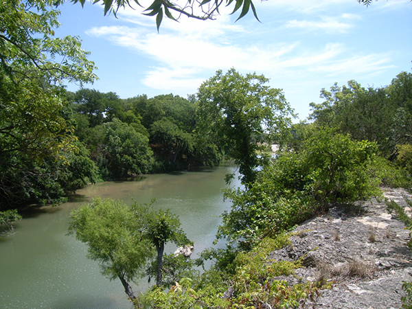
- Waterbodies: Shrank by 60%, from 12.3% (37.3 sqkm) in 1980 to 4.8% (14.7 sqkm) in 2024.
- Urban Structures: Increased sevenfold, from 20.7 sqkm to 148.8 sqkm.
- Grass and Agricultural Land: Declined from 168.8 sqkm to 74.4 sqkm.
- Average Annual Temperature: Rose from 36.8°C in 1990 to 39.8°C in 2024.
Alignment with Sustainable Development Goals (SDGs)
The study’s findings highlight significant challenges to achieving the SDGs in Dhaka, particularly concerning urban sustainability, health, climate action, and ecosystem preservation.
SDG 11: Sustainable Cities and Communities
The city’s development pattern directly contravenes the objectives of SDG 11, which aims to make cities inclusive, safe, resilient, and sustainable.
- Target 11.7 (Access to Green Spaces): The city fails to provide adequate green space per capita as recommended by the World Health Organisation (WHO).
- WHO Standard: 9 square metres of tree cover per capita.
- Dhaka North City Corporation (DNCC): Average of 4.23 sq m per capita. Areas like Adabar, Rampura, and Kafrul have the lowest coverage.
- Dhaka South City Corporation (DSCC): Average of 2.33 sq m per capita. Areas such as Sutrapur, Bangshal, and Wari have almost no tree cover.
- Sustainable Urbanization: The unchecked expansion of built-up areas undermines sustainable planning.
- RAJUK Limit: Maximum 50% built-up area.
- Areas Exceeding Limits: Over 80% of the area in Adabar, Mirpur, Rampura, Bangshal, Sutrapur, Wari, and Hazaribagh is built-up, indicating unsustainable densification.
SDG 3: Good Health and Well-being
The degradation of the urban environment poses a direct threat to the health and well-being of Dhaka’s residents, undermining SDG 3.
- Per Capita Green Space: The deficit in tree cover (4.23 sq m in DNCC, 2.33 sq m in DSCC) compared to the WHO’s 9 sq m standard impacts physical and mental health.
- Per Capita Waterbodies: The city falls drastically short of the WHO’s recommended 4.5 sq m of waterbody per capita.
- DNCC: 1.79 square metres per capita.
- DSCC: 0.97 square metres per capita.
- Mirpur, Kafrul, Sutrapur, and Gandaria are identified as nearly dry zones.
SDG 13: Climate Action & SDG 15: Life on Land
The extensive loss of vegetation and waterbodies exacerbates local climate change effects and represents a significant loss of urban biodiversity, impacting SDG 13 and SDG 15.
- Target 15.5 (Halt Biodiversity Loss): The 50% reduction in tree cover and the near-total loss of grass and agricultural land in areas like Adabar, Hatirjheel, and Sutrapur signify a severe degradation of urban terrestrial ecosystems.
- Target 13.1 (Strengthen Resilience to Climate Hazards): The loss of green cover has intensified the urban heat island effect, demonstrated by the 3°C rise in average maximum temperature since 1990.
- Hottest Zones (>32°C): Shyampur, Hazaribagh, Tejgaon, Rampura, Darussalam.
- Cooler Zones ( Shahbagh, Sabujbagh, Demra, Uttarkhan, Cantonment.
SDG 6: Clean Water and Sanitation
The dramatic 60% reduction in waterbodies is a critical setback for SDG 6, particularly Target 6.6, which calls for the protection and restoration of water-related ecosystems.
- The disappearance of waterbodies in areas like Sutrapur and Gandaria threatens local water cycles, groundwater recharge, and the overall ecological balance of the city.
1. Which SDGs are addressed or connected to the issues highlighted in the article?
SDG 11: Sustainable Cities and Communities
- The article is centered on Dhaka city, analyzing its urban development, loss of green spaces, and water bodies. This directly relates to making cities inclusive, safe, resilient, and sustainable.
SDG 15: Life on Land
- The study’s findings on the significant loss of trees (“lost half of its trees”) and the decline of “grass and agricultural land” directly address the protection and restoration of terrestrial ecosystems.
SDG 6: Clean Water and Sanitation
- The article highlights a 60% loss of water bodies, which pertains to the protection and restoration of water-related ecosystems, a key aspect of SDG 6.
SDG 13: Climate Action
- The reported rise in the city’s average temperature (“maximum average annual temperature has risen to 39.8C by 2024, up from 36.8C in 1990”) connects the environmental degradation to climate-related impacts like the urban heat island effect.
SDG 3: Good Health and Well-being
- The article explicitly references World Health Organisation (WHO) standards for per capita tree cover and waterbody coverage, linking the lack of green and blue infrastructure to public health standards.
2. What specific targets under those SDGs can be identified based on the article’s content?
-
SDG Target 11.7: Provide universal access to safe, inclusive and accessible, green and public spaces.
- The article directly discusses the inadequacy of green spaces by comparing Dhaka’s per capita tree cover to the WHO’s minimum standard. It states, “In DNCC, the average tree cover is just 4.23 square metres per capita—only half of the minimum standard of 9 square metres per capita set by the World Health Organisation.” This highlights a failure to provide adequate public green space.
-
SDG Target 11.3: Enhance inclusive and sustainable urbanization and capacity for sustainable human settlement planning.
- The article points to unsustainable urbanization by noting that “urban structures have increased sevenfold” and that many areas like Adabar, Mirpur, and Rampura are “choked with over 80 per cent built-up areas,” exceeding the limits set by the city’s development authority.
-
SDG Target 15.1: Ensure the conservation, restoration and sustainable use of terrestrial and inland freshwater ecosystems.
- The core findings of the study—that Dhaka “has lost half of its trees and 60 per cent of its waterbodies over the past 44 years”—directly relate to the failure to conserve these ecosystems.
-
SDG Target 6.6: Protect and restore water-related ecosystems.
- The dramatic reduction of water bodies, which “shrank from 12.3 per cent, or 37.3 square kilometres to 4.8 per cent, or 14.7 square kilometres,” is a direct measure of the degradation of water-related ecosystems.
-
SDG Target 13.1: Strengthen resilience and adaptive capacity to climate-related hazards.
- The increase in the city’s maximum average temperature to 39.8°C is a climate-related hazard. The loss of trees and water bodies, which naturally cool the environment, reduces the city’s resilience and adaptive capacity to extreme heat.
3. Are there any indicators mentioned or implied in the article that can be used to measure progress towards the identified targets?
-
Indicator for Target 11.7 (Access to public spaces):
- The article provides quantitative data that can serve as an indicator: “average tree cover is just 4.23 square metres per capita” and “average waterbody coverage… is only 1.79 square metres per capita.” These figures can be tracked over time to measure progress. The percentage of land covered by trees (declined from 21.6% to 11.6%) is another direct indicator.
-
Indicator for Target 11.3 (Sustainable urbanization):
- The “sevenfold” increase in urban structures from “20.7sqkm to 148.8sqkm” serves as an indicator of the land consumption rate. Additionally, the percentage of built-up area in different thanas (e.g., “over 80 per cent built-up areas” in some parts) is a clear indicator of urban density and sprawl.
-
Indicator for Target 15.1 & 6.6 (Change in ecosystem extent):
- The article provides precise indicators for the change in the extent of ecosystems over time. For terrestrial ecosystems, tree cover “declined to 11.6 per cent, or 35.3 square kilometres.” For water-related ecosystems, water bodies “shrank from 12.3 per cent… to 4.8 per cent.”
-
Indicator for Target 13.1 (Climate hazards):
- The change in temperature, “the maximum average annual temperature has risen to 39.8C by 2024, up from 36.8C in 1990,” is a direct indicator of the increasing intensity of a climate-related hazard (extreme heat).
4. Table of SDGs, Targets, and Indicators
| SDGs | Targets | Indicators Identified in the Article |
|---|---|---|
| SDG 11: Sustainable Cities and Communities | 11.7: Provide universal access to safe, inclusive and accessible, green and public spaces. | Per capita tree cover (e.g., 4.23 sq metres in DNCC); Per capita waterbody coverage (e.g., 0.97 sq metre in DSCC); Percentage of land covered by trees (declined from 21.6% to 11.6%). |
| SDG 11: Sustainable Cities and Communities | 11.3: Enhance inclusive and sustainable urbanization. | Increase in urban structures (from 20.7 sqkm to 148.8 sqkm); Percentage of built-up area in specific city zones (e.g., over 80% in Adabar, Mirpur). |
| SDG 15: Life on Land | 15.1: Ensure the conservation and restoration of terrestrial and inland freshwater ecosystems. | Total loss of trees (half lost); Decline in tree cover area (from 65.7 sqkm to 35.3 sqkm); Decline in grass and agricultural land (from 168.8 sqkm to 74.4 sqkm). |
| SDG 6: Clean Water and Sanitation | 6.6: Protect and restore water-related ecosystems. | Total loss of waterbodies (60% lost); Change in extent of water bodies (from 12.3% to 4.8% of city area, or 37.3 sqkm to 14.7 sqkm). |
| SDG 13: Climate Action | 13.1: Strengthen resilience and adaptive capacity to climate-related hazards. | Increase in maximum average annual temperature (from 36.8°C in 1990 to 39.8°C in 2024). |
Source: newagebd.net

What is Your Reaction?
 Like
0
Like
0
 Dislike
0
Dislike
0
 Love
0
Love
0
 Funny
0
Funny
0
 Angry
0
Angry
0
 Sad
0
Sad
0
 Wow
0
Wow
0