


Combining USV ROV and multimetric indices to assess benthic habitat quality in coastal areas – Nature

Report on the Assessment of Benthic Habitat Quality in Coastal Areas Using Integrated Remote Sensing Technologies and Multimetric Indices
Abstract
Coastal marine ecosystems, vital for biodiversity and ecosystem services, face significant threats from human activities along coastlines and continental shelves. This report evaluates an integrated remote sensing methodology combining autonomous Unmanned Surface Vehicles (USVs) and Remotely Operated Vehicles (ROVs) with multimetric habitat quality indices to assess benthic habitats in three coastal areas of the northeastern Tyrrhenian Sea, Italy. The approach demonstrated moderate habitat quality across sites and proved effective for application in heterogeneous seabeds globally. This methodology supports Sustainable Development Goals (SDGs), particularly SDG 14 (Life Below Water), by enhancing monitoring capabilities and informing conservation efforts.
Introduction
Coastal ecosystems are characterized by complex physical and biological processes with high biodiversity, yet they are increasingly threatened by human pressures and climate change. Over half of the world’s coastal ecosystems are under threat, with the Mediterranean Sea being a biodiversity hotspot facing significant anthropogenic impacts. Habitats such as Posidonia oceanica meadows and coralligenous bioconstructions are particularly vulnerable.
Effective monitoring systems that are sustainable, cost-effective, and capable of extensive data collection are essential for assessing ecological status and guiding conservation actions aligned with SDG 14. However, current marine monitoring technologies face limitations in affordability and user-friendliness.
Recent advances in autonomous platforms like USVs and ROVs offer enhanced maneuverability, autonomy, and data acquisition efficiency. Integrating these technologies with ecological quality indices can improve habitat assessments, supporting international frameworks such as the EU Marine Strategy Framework Directive (MSFD) and the Mediterranean Action Plan (UNEP MAP).
Methodology
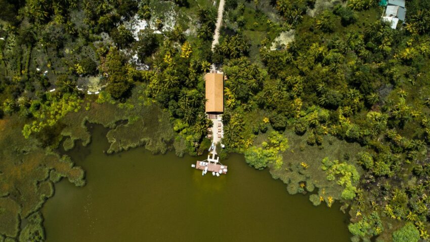
Study Sites and Data Acquisition
- Capo Linaro (CL): A Special Area of Conservation (SAC) with rocky shoreline habitats.
- Macchiatonda (MT): A SAC featuring sandy beach environments within the Capo Linaro – Capo Anzio physiographic unit.
- Tor Paterno Marine Protected Area (TP MPA): A designated Marine Protected Area with diverse habitats including rocky and soft bottoms, seagrass meadows, and coralligenous bioconstructions.
These areas host habitats of community importance under the EU Habitats Directive, including Posidonia oceanica meadows (1120) and reefs (1170).
USV surveys equipped with single-beam echosounders were conducted along coast-to-offshore transects to collect data on bottom depth, substrate type, and submerged vegetation characteristics. ROVs and scientific divers provided ground-truthing through video footage and in-situ observations, enabling detailed habitat quality assessments.
Application of Ecological Quality Indices
Multimetric indices, specifically adapted versions of the Mesophotic Assemblages Ecological Status Index (MAES) and its abbreviated form (q-MAES), were applied to assess habitat quality. These indices integrate parameters such as taxa richness, biotic cover, erect species density and height, epibiosis/necrosis presence, and marine litter density.
Data from ROV videos and USV echosounder surveys were combined to calculate two indices:
- Index-A: Incorporates a comprehensive set of biotic and abiotic parameters.
- Index-B: A simplified version focusing on key habitat quality metrics.
Scores were assigned based on reference conditions representing optimal habitat states, and habitats were classified into quality classes: bad, moderate, and good.
Results
Habitat Characterization
ROV video analysis identified eight taxa groups across the study sites, including plants, algae, sponges, hydrozoans, anthozoans, polychaetes, ascidians, and bryozoans.
USV surveys revealed the following habitat features:
- CL Area: Maximum depth of 13.95 m; predominance of vegetated rocky bottoms (64.02%) and extensive Posidonia oceanica meadows (35.98%) with canopy heights up to 1.2 m and 40.26% coverage.
- MT Area: Depths up to 25 m; heterogeneous seabed with rocky (31.69%), soft (7.12%), Posidonia oceanica (32.55%), and coralligenous bioconstructions (28.64%). The seagrass showed patchy distribution and canopy heights up to 0.61 m.
- TP MPA: Depths reaching 19.64 m; highly heterogeneous with rocky and soft bottoms, seagrass patches (39.31%), and coralligenous bioconstructions. Biodiversity was higher compared to CL and MT.
Habitat Quality Assessment
Both Index-A and Index-B classified the habitat quality as moderate across all sites, with the TP area tending towards a good classification under Index-A. Biodiversity metrics indicated higher species richness in the TP MPA, potentially influenced by its protected status and hydrodynamic conditions.
Discussion
Assessing benthic habitat quality in heterogeneous coastal environments is complex due to overlapping habitats and dynamic conditions. The integrated use of USV and ROV technologies combined with multimetric indices provides a practical, cost-effective approach to overcome these challenges, aligning with SDG 14 targets to conserve and sustainably use marine resources.
Limitations include potential underestimation of species richness due to sampling scope and seasonal variability. Continuous and extensive monitoring is recommended to improve assessment accuracy and detect temporal changes.
The moderate habitat quality findings are consistent with regional assessments under the MSFD and highlight the importance of Marine Protected Areas (MPAs) in maintaining ecological integrity, supporting SDG 15 (Life on Land) through ecosystem conservation.
Future improvements should integrate terrestrial and marine anthropogenic pressures, including land use and water quality indicators, to enhance habitat quality assessments and support SDG 6 (Clean Water and Sanitation) and SDG 11 (Sustainable Cities and Communities).
The methodology’s potential to provide high-resolution, near real-time data supports the development of Digital Twins of the Ocean (DTOs), enhancing marine spatial planning and ecosystem-based management in line with SDG 13 (Climate Action).
Conclusions
- The integrated remote sensing approach combining USV and ROV technologies with multimetric habitat quality indices effectively assesses benthic habitats in coastal areas with heterogeneous seabeds.
- All study sites exhibited moderate habitat quality, with the Marine Protected Area showing higher biodiversity and better ecological status.
- This methodology supports global efforts to achieve Sustainable Development Goals, particularly SDG 14, by providing reliable data for marine ecosystem monitoring, conservation, and management.
- Future research will expand the application of this approach to additional coastal regions to validate its robustness and contribute to sustainable marine resource use.
Recommendations for Sustainable Development Goals Integration
- SDG 14 (Life Below Water): Enhance marine biodiversity monitoring and protection through innovative, cost-effective technologies.
- SDG 15 (Life on Land): Support ecosystem conservation by integrating terrestrial and marine environmental data.
- SDG 6 (Clean Water and Sanitation): Incorporate water quality indicators into habitat assessments to address pollution impacts.
- SDG 11 (Sustainable Cities and Communities): Address coastal development pressures by integrating land use data with marine habitat quality indices.
- SDG 13 (Climate Action): Utilize high-resolution monitoring data to inform climate resilience and adaptation strategies for coastal ecosystems.
Data Availability
All data generated and analyzed in this study are available from the corresponding author upon request.
1. Sustainable Development Goals (SDGs) Addressed or Connected
- SDG 14: Life Below Water
- The article focuses on coastal marine ecosystems, benthic habitats, and marine biodiversity, which are core aspects of SDG 14.
- It discusses threats from human activities and climate change to marine biodiversity and habitats such as Posidonia oceanica meadows and coralligenous bioconstructions.
- The study supports monitoring and conservation efforts aligned with marine environmental protection directives.
- SDG 13: Climate Action
- The article mentions the impact of climate change on coastal ecosystems, including global warming and ocean acidification effects on coralligenous bioconstructions.
- It highlights the need for improved monitoring to understand ecosystem responses to environmental changes.
- SDG 11: Sustainable Cities and Communities
- Coastal areas are affected by human activities and urban development, and the article addresses the need for sustainable monitoring and management of coastal zones.
- SDG 9: Industry, Innovation and Infrastructure
- The article emphasizes innovative autonomous platforms (USVs and ROVs) and remote sensing technologies for ecosystem monitoring.
- It promotes cost-effective, advanced technological solutions for environmental monitoring.
2. Specific Targets Under the Identified SDGs
- SDG 14: Life Below Water
- Target 14.2: Sustainably manage and protect marine and coastal ecosystems to avoid significant adverse impacts, and take action for their restoration.
- Target 14.5: Conserve at least 10% of coastal and marine areas, consistent with national and international law.
- Target 14.3: Minimize and address the impacts of ocean acidification.
- SDG 13: Climate Action
- Target 13.1: Strengthen resilience and adaptive capacity to climate-related hazards and natural disasters in all countries.
- Target 13.3: Improve education, awareness-raising and human and institutional capacity on climate change mitigation, adaptation, impact reduction, and early warning.
- SDG 11: Sustainable Cities and Communities
- Target 11.4: Strengthen efforts to protect and safeguard the world’s cultural and natural heritage, including coastal and marine environments impacted by urbanization.
- SDG 9: Industry, Innovation and Infrastructure
- Target 9.5: Enhance scientific research and upgrade the technological capabilities of industrial sectors, including environmental monitoring technologies.
3. Indicators Mentioned or Implied to Measure Progress
- Ecological Quality Indices
- Multimetric habitat quality indices such as MAES (Mesophotic Assemblages Ecological Status Index), q-MAES, POMI (Posidonia oceanica Multivariate Index), PREI (Posidonia oceanica Rapid Easy Index), ESCA (Ecological Status of Coralligenous Assemblages), MAES, COARSE, and ISLA indices are used to assess habitat quality.
- These indices incorporate metrics like species richness, biotic cover, erect species density and height, epibiosis/necrosis percentage, and marine litter density.
- Remote Sensing Data
- Data from Unmanned Surface Vehicles (USV) equipped with echosounders provide measurements of bottom depth, bottom type (hard/soft), submerged vegetation height and coverage.
- Remotely Operated Vehicles (ROV) provide video footage for ground-truthing and species identification.
- Biodiversity Metrics
- Number of megabenthic taxa (species richness) as a proxy for biodiversity.
- Presence and distribution of key species such as Posidonia oceanica, coralligenous bioconstructions, and macro benthic species.
- Environmental Parameters
- Indicators related to human impacts such as marine litter density and epibiosis/necrosis on flora and fauna.
- Abiotic factors like bottom type classification and vegetation height.
4. Table of SDGs, Targets, and Indicators
| SDGs | Targets | Indicators |
|---|---|---|
| SDG 14: Life Below Water |
|
|
| SDG 13: Climate Action |
|
|
| SDG 11: Sustainable Cities and Communities |
|
|
| SDG 9: Industry, Innovation and Infrastructure |
|
|
Source: nature.com
![]()
What is Your Reaction?
 Like
0
Like
0
 Dislike
0
Dislike
0
 Love
0
Love
0
 Funny
0
Funny
0
 Angry
0
Angry
0
 Sad
0
Sad
0
 Wow
0
Wow
0