


![Lancaster homeowner’s energy-efficient renovation sparks clash over historic preservation [Lancaster Watchdog] – LancasterOnline](https://bloximages.newyork1.vip.townnews.com/lancasteronline.com/content/tncms/assets/v3/editorial/9/ed/9ed03d32-c902-44d2-a461-78ad888eec38/69050b156baeb.image.png?resize=150,75#)


New model reveals dramatic swings in ancient sea levels – Earth.com
Report on a New Study of Historical Sea-Level Changes and Its Implications for Sustainable Development Goals
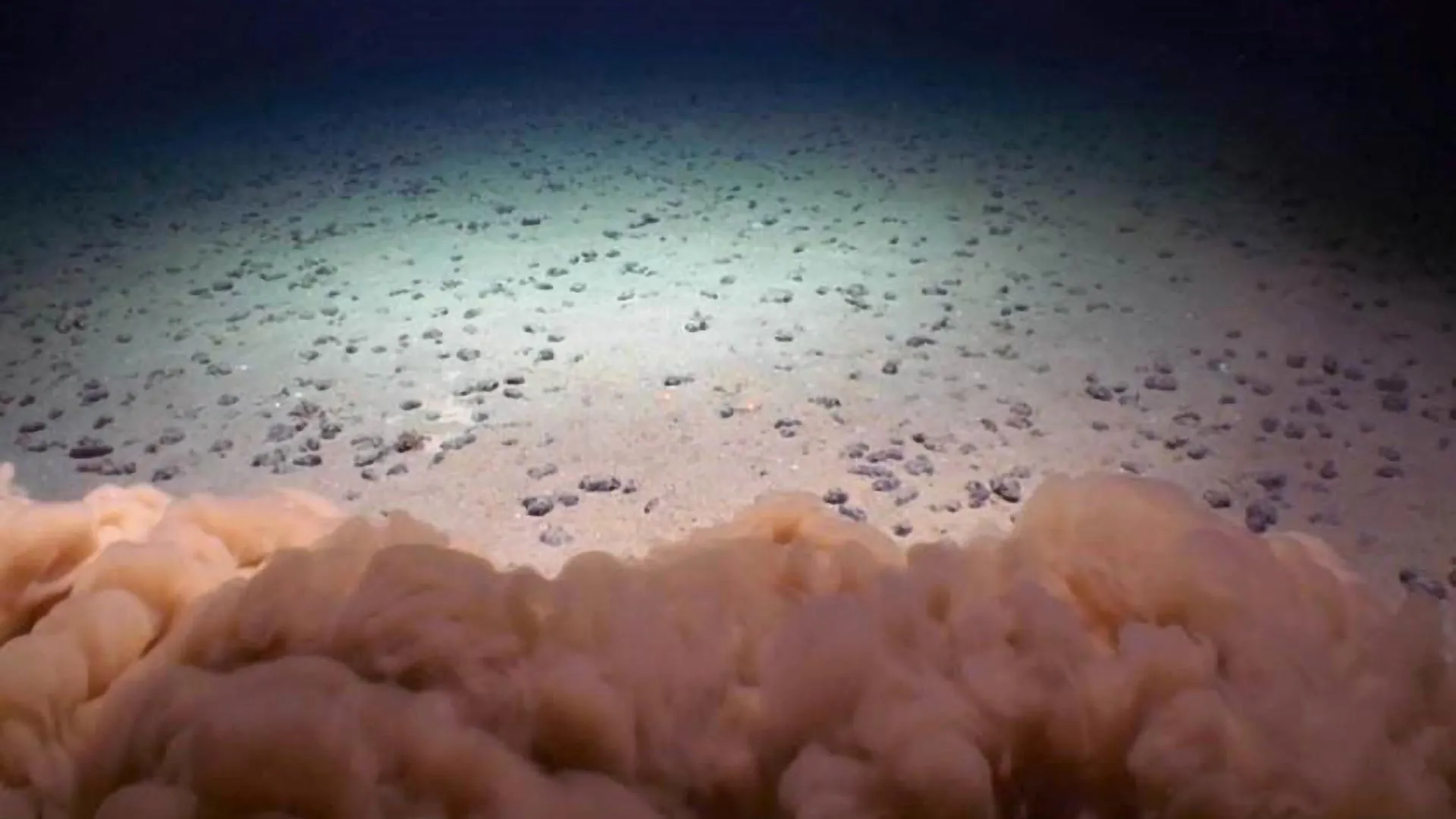
A recent study published in Earth and Planetary Science Letters by researchers from Utrecht, the UK, and the United States presents a novel model for mapping sea-level changes over the last 540 million years. By integrating paleoclimate data with Earth’s orbital cycles, the research provides unprecedented detail on short-term fluctuations, offering critical insights that directly support the achievement of several United Nations Sustainable Development Goals (SDGs).
Research Methodology and Key Findings
The study moves beyond traditional million-year analyses by correlating sediment records with Milankovitch cycles—the periodic wobbles in Earth’s orbit that influence climate on scales of 20,000 to 400,000 years. This approach allows for the estimation of rapid sea-level variations driven by the growth and decay of ice sheets.
Major Discoveries
- Short-Term Volatility: During “icehouse” periods, such as the late Carboniferous and the modern era, orbital cycles could trigger sea-level shifts of up to 100 meters within tens of thousands of years.
- Greenhouse Stability: In warmer, ice-free “greenhouse” periods like the mid-Cretaceous, sea levels remained relatively stable, with fluctuations generally under 50 meters.
- Model Validation: The model’s estimates align with sedimentary records from the Silurian, Devonian, and Cretaceous periods, confirming its accuracy.
Implications for Sustainable Development Goals (SDGs)
The study’s findings have significant practical applications for building a sustainable future, directly contributing to the progress of key SDGs.
SDG 7: Affordable and Clean Energy
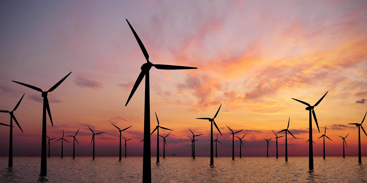
Understanding historical sea-level changes enhances our ability to locate and utilize subsurface resources for clean energy. The research provides a framework for creating global maps of geological layers essential for green energy infrastructure.
- Geothermal Energy and Hydrogen Storage: Sandstone layers, deposited during periods of low sea level, form ideal reservoirs for storing hydrogen or harnessing geothermal heat.
- Reservoir Sealing: Claystone layers, formed during high sea-level periods, act as effective seals, ensuring the safe and contained storage of energy resources.
SDG 9: Industry, Innovation, and Infrastructure & SDG 11: Sustainable Cities and Communities
The innovative modeling technique provides a tool for developing resilient and sustainable infrastructure. By predicting the location of suitable geological formations, the research supports the safe, long-term use of the subsurface, which is critical for sustainable urban and industrial development.
- This knowledge helps de-risk investments in large-scale infrastructure projects for energy storage and waste management.
- It contributes to building safer communities by ensuring that critical materials, such as radioactive waste, are stored in geologically stable locations.
SDG 12: Responsible Consumption and Production & SDG 13: Climate Action
The study provides a deep historical context for current environmental challenges, informing strategies for climate action and responsible resource management.
- Climate Action (SDG 13): By detailing how Earth’s climate system and sea levels responded to past orbital and temperature changes, the model helps refine predictions for future climate scenarios and strengthens the scientific basis for climate policy.
- Responsible Production (SDG 12): The ability to identify secure locations for radioactive waste disposal is a cornerstone of responsible nuclear energy production, ensuring that waste products are managed safely for millennia.
Conclusion and Future Directions
This research marks a significant advancement in our understanding of Earth’s dynamic history. Its application extends far beyond geology, providing a scientifically grounded tool to support global efforts in achieving a sustainable and secure future. The study demonstrates that exploring our planet’s deep past is essential for addressing present-day challenges related to clean energy, climate action, and resilient infrastructure. Future work aims to refine the model further, promising even greater precision in guiding the sustainable use of Earth’s subsurface resources.
1. Which SDGs are addressed or connected to the issues highlighted in the article?
-
SDG 7: Affordable and Clean Energy
- The article explicitly states that the research findings can “improve models for geothermal energy, hydrogen storage.” These are forms of clean energy, and understanding subsurface geology is crucial for their development and implementation.
-
SDG 9: Industry, Innovation, and Infrastructure
- The study represents a significant scientific innovation, combining paleoclimate data, sediment records, and orbital modeling. It also supports the development of sustainable infrastructure by helping to identify safe locations for energy storage and waste disposal, as mentioned in the text: “Mapping these layers globally can help in safe subsurface use.”
-
SDG 12: Responsible Consumption and Production
- The research contributes to the environmentally sound management of waste, a key aspect of this goal. The article notes that the findings can improve models for “radioactive waste disposal,” which requires secure and stable geological formations.
-
SDG 13: Climate Action
- The entire article is centered on understanding sea level rise, a primary consequence and indicator of climate change. By mapping historical sea level changes, the research helps to “better understand Earth’s climate,” improve climate models, and comprehend the dynamics of “greenhouse vs. icehouse worlds,” which is fundamental to addressing climate change.
-
SDG 17: Partnerships for the Goals
- The study is a result of international scientific cooperation, as stated in the article: “researchers from Utrecht, the UK, and the United States have mapped sea level changes.” This collaboration is essential for advancing global scientific knowledge.
2. What specific targets under those SDGs can be identified based on the article’s content?
-
Target 7.2: Increase substantially the share of renewable energy in the global energy mix.
- The research supports this target by providing geological insights that facilitate the development of renewable energy sources like “geothermal energy” and energy storage solutions like “hydrogen storage,” which are necessary for a stable renewable energy grid.
-
Target 9.5: Enhance scientific research, upgrade the technological capabilities of industrial sectors in all countries, in particular developing countries, encouraging innovation.
- The study itself is a direct example of enhanced scientific research. By developing a new model to map sea level changes, it upgrades the technological capabilities available for geological and climate science.
-
Target 12.4: Achieve the environmentally sound management of chemicals and all wastes throughout their life cycle.
- The article’s mention of using the research to improve models for “radioactive waste disposal” directly relates to this target, as it aims to ensure waste is managed safely and with minimal environmental impact by identifying secure subsurface storage locations.
-
Target 13.1: Strengthen resilience and adaptive capacity to climate-related hazards and natural disasters in all countries.
- Understanding past sea level fluctuations, including rapid changes of “as much as 100 meters (328 feet),” is crucial for predicting future changes and strengthening the resilience of coastal regions and infrastructure against the climate-related hazard of sea level rise.
-
Target 17.6: Enhance North-South, South-South and triangular regional and international cooperation on and access to science, technology and innovation.
- The collaboration between researchers from “Utrecht, the UK, and the United States” is a clear fulfillment of this target, demonstrating international cooperation to advance science and technology.
3. Are there any indicators mentioned or implied in the article that can be used to measure progress towards the identified targets?
-
Rate of historical sea level change
- The article explicitly mentions quantifiable changes in sea level, such as swings of “200-meter (656 feet) over million-year periods” and “100 meters (328 feet)” during ice ages lasting tens of thousands of years. These measurements serve as indicators for understanding the scale and speed of climate-related hazards (Target 13.1).
-
Development of models for clean energy and waste management
- The article implies that the research leads to the creation of improved models. Progress can be measured by the development and application of these new models for “geothermal energy, hydrogen storage, and radioactive waste disposal” (Targets 7.2, 12.4).
-
Number of international scientific collaborations and publications
- The article itself, being a study published in the journal Earth and Planetary Science Letters by a team from three different countries, is an indicator of international cooperation in science (Target 17.6) and the output of enhanced scientific research (Target 9.5).
4. SDGs, Targets and Indicators Table
| SDGs | Targets | Indicators |
|---|---|---|
| SDG 7: Affordable and Clean Energy | 7.2: Increase substantially the share of renewable energy in the global energy mix. | (Implied) Improved geological models for identifying suitable sites for geothermal energy and hydrogen storage. |
| SDG 9: Industry, Innovation, and Infrastructure | 9.5: Enhance scientific research, upgrade the technological capabilities of industrial sectors… encouraging innovation. | (Explicit) Publication of new scientific research that advances modeling techniques. |
| SDG 12: Responsible Consumption and Production | 12.4: Achieve the environmentally sound management of chemicals and all wastes throughout their life cycle. | (Implied) Development of models to identify safe subsurface locations for radioactive waste disposal. |
| SDG 13: Climate Action | 13.1: Strengthen resilience and adaptive capacity to climate-related hazards and natural disasters in all countries. | (Explicit) Measurement and modeling of historical sea level changes (e.g., swings of 100-200 meters). |
| SDG 17: Partnerships for the Goals | 17.6: Enhance… international cooperation on and access to science, technology and innovation. | (Explicit) The existence of a collaborative research project between institutions in Utrecht, the UK, and the United States. |
Source: earth.com

What is Your Reaction?
 Like
0
Like
0
 Dislike
0
Dislike
0
 Love
0
Love
0
 Funny
0
Funny
0
 Angry
0
Angry
0
 Sad
0
Sad
0
 Wow
0
Wow
0