


DNR Launches Coastal Floods Planning Tool – Maryland Association of Counties

Report on the Maryland Coastal Flood Explorer and its Contribution to Sustainable Development Goals
Introduction: A New Tool for Climate Resilience and Sustainable Development
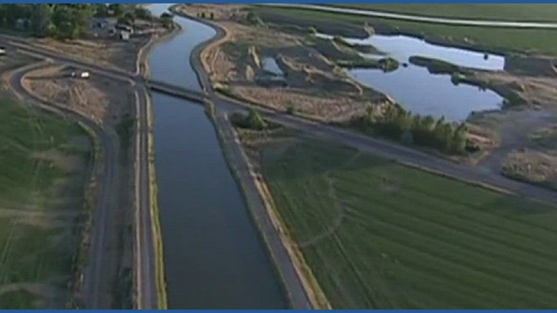
The Maryland Department of Natural Resources has launched the Maryland Coastal Flood Explorer, an interactive mapping tool designed to enhance coastal flood preparedness. This initiative directly supports the United Nations Sustainable Development Goals (SDGs) by providing critical data and visualizations to residents and community planners. The tool facilitates informed decision-making to build resilience against climate-related hazards, aligning with global efforts to create sustainable and safe environments.
Alignment with SDG 11: Sustainable Cities and Communities
The Coastal Flood Explorer is a key asset for achieving SDG 11, which aims to make cities and human settlements inclusive, safe, resilient, and sustainable. By providing accessible data on flood risks, the tool directly addresses Target 11.5, which focuses on reducing the impact of water-related disasters, and Target 11.b, which promotes integrated policies for disaster resilience.
Community Planning Applications for Enhanced Resilience
- Updating hazard mitigation plans, comprehensive plans, and nuisance flood plans.
- Identifying priority areas for adaptation, restoration, and mitigation projects.
- Communicating risks associated with flooding and sea-level rise for broad outreach and education.
- Allowing residents to assess flood risk to their property, transportation routes, and valuable community spaces like parks and schools.
Advancing SDG 13: Climate Action
The tool is a direct response to the challenges of climate change, contributing to SDG 13 (Climate Action). It strengthens resilience and adaptive capacity to climate-related hazards (Target 13.1) by visualizing the local impacts of sea-level rise and extreme weather. It also serves as an educational resource, improving awareness and institutional capacity for climate change adaptation and early warning (Target 13.3).
Tool Features for Climate Adaptation
- Visualization of current and future high-tide flooding scenarios.
- Projections for Maryland-specific sea-level rise by decade through 2120.
- Analysis of historic flood events, such as Superstorm Sandy and Hurricane Isabel, to inform future preparedness.
Fostering Innovation and Resilient Infrastructure (SDG 9)
As an innovative technological solution, the Maryland Coastal Flood Explorer supports SDG 9 (Industry, Innovation, and Infrastructure). It provides the necessary data for planning and developing sustainable and resilient infrastructure (Target 9.1) capable of withstanding climate impacts. By identifying vulnerable areas, the tool helps guide investments toward infrastructure projects that ensure community safety and continuity.
Collaborative Efforts in Support of SDG 17: Partnerships for the Goals
The development of the Coastal Flood Explorer exemplifies SDG 17 (Partnerships for the Goals), which encourages collaboration to achieve sustainable development. The project was made possible through a multi-stakeholder partnership that brought together governmental and academic institutions, ensuring the tool is built on high-quality, localized data.
Key Project Collaborators
- Maryland Department of Natural Resources
- National Oceanic and Atmospheric Administration (NOAA)
- Salisbury University’s Eastern Shore GIS Cooperative (ESRGC)
- University of Maryland Sea Grant and Sea Grant Extension
- University of Maryland Center for Environmental Science
Conclusion and Future Outlook
The Maryland Coastal Flood Explorer is a critical resource for advancing the state’s resilience to coastal hazards. Its implementation strongly aligns with the principles of the Sustainable Development Goals, particularly in the areas of building resilient communities, taking climate action, fostering innovation, and promoting partnerships. Continued utilization of this tool will empower local governments and residents to plan for a safe and sustainable future. Further discussions on these strategies, such as at the MACo Summer Conference, will be vital for integrating these tools into local government planning and funding frameworks.
Analysis of Sustainable Development Goals (SDGs) in the Article
1. Which SDGs are addressed or connected to the issues highlighted in the article?
- SDG 11: Sustainable Cities and Communities: The article focuses on a tool designed to help Maryland communities plan for and adapt to coastal flooding, making them more resilient and sustainable. It directly addresses the safety and planning of human settlements in the face of environmental hazards.
- SDG 13: Climate Action: The core issue discussed is coastal flooding, which is exacerbated by sea-level rise—a direct consequence of climate change. The tool is an adaptation measure to strengthen resilience and adaptive capacity to climate-related hazards and natural disasters.
- SDG 17: Partnerships for the Goals: The article explicitly mentions the collaboration between multiple organizations to create the tool, including the Department of Natural Resources, NOAA, Salisbury University, and the University of Maryland. This highlights a multi-stakeholder partnership to achieve a common goal.
2. What specific targets under those SDGs can be identified based on the article’s content?
-
SDG 11: Sustainable Cities and Communities
- Target 11.5: “By 2030, significantly reduce the number of deaths and the number of people affected and substantially decrease the direct economic losses… caused by disasters, including water-related disasters…” The article’s focus on a tool for “coastal flood preparedness” is a direct effort to mitigate the impact of water-related disasters on communities and residents.
- Target 11.b: “…substantially increase the number of cities and human settlements adopting and implementing integrated policies and plans towards… adaptation to climate change, resilience to disasters…” The article states the tool is for “updating hazard mitigation plans, comprehensive plans, and nuisance flood plans,” which are local disaster resilience plans.
-
SDG 13: Climate Action
- Target 13.1: “Strengthen resilience and adaptive capacity to climate-related hazards and natural disasters in all countries.” The “Maryland Coastal Flood Explorer” is designed to “enhance coastal flood preparedness” and help communities identify “priority areas for adaptation and mitigation projects,” directly contributing to this target.
- Target 13.3: “Improve education, awareness-raising and human and institutional capacity on climate change mitigation, adaptation, impact reduction and early warning.” The tool is intended for “communicating about flooding and sea level rise for broad outreach and education,” allowing residents to understand their personal and community risk.
-
SDG 17: Partnerships for the Goals
- Target 17.17: “Encourage and promote effective public, public-private and civil society partnerships…” The article details the creation of the tool “in collaboration with Salisbury University’s Eastern Shore GIS Cooperative (ESRGC), University of Maryland Sea Grant, and University of Maryland Sea Grant Extension,” with support from the “National Oceanic and Atmospheric Administration (NOAA).” This is a clear example of a public-academic partnership.
3. Are there any indicators mentioned or implied in the article that can be used to measure progress towards the identified targets?
-
Target 11.5 / 13.1
- Indicator: The increasing frequency of climate-related hazards. The article provides a specific metric: “The average number of minor flood days per year in Annapolis has quadrupled from the 1970s to present day.”
- Indicator: The availability of future risk projections. The tool provides “Projections for sea-level rise by decade through 2120,” which is a key indicator for planning.
-
Target 11.b
- Indicator: Adoption of local disaster risk reduction strategies. The article implies this can be measured by the number of communities using the tool for “updating hazard mitigation plans, comprehensive plans, and nuisance flood plans.”
-
Target 13.3
- Indicator: Availability of public access information and education tools. The existence and launch of the “Maryland Coastal Flood Explorer,” a “user-friendly and interactive mapper,” serves as an indicator for improved education and awareness-raising.
-
Target 17.17
- Indicator: The number and type of multi-stakeholder partnerships. The article identifies a specific partnership between state (DNR), federal (NOAA), and academic (Salisbury University, University of Maryland) institutions.
4. Summary of SDGs, Targets, and Indicators
| SDGs | Targets | Indicators |
|---|---|---|
| SDG 11: Sustainable Cities and Communities |
11.5: Reduce the number of people affected by water-related disasters.
11.b: Increase the number of cities implementing policies for resilience to disasters. |
– The number of communities using the tool to update hazard mitigation plans, comprehensive plans, and nuisance flood plans. – Data on historic flood events (e.g., Superstorm Sandy, Hurricane Isabel) used for planning. |
| SDG 13: Climate Action |
13.1: Strengthen resilience and adaptive capacity to climate-related hazards.
13.3: Improve education and awareness-raising on climate change adaptation. |
– The quadrupling of minor flood days per year in Annapolis since the 1970s. – The public availability of the “Maryland Coastal Flood Explorer” as an educational tool. – The inclusion of Maryland-specific sea-level rise projections through 2120 in the tool. |
| SDG 17: Partnerships for the Goals | 17.17: Encourage and promote effective public, public-private and civil society partnerships. | – The documented collaboration between the Department of Natural Resources, NOAA, Salisbury University, and the University of Maryland to create the tool. |
Source: conduitstreet.mdcounties.org

What is Your Reaction?
 Like
0
Like
0
 Dislike
0
Dislike
0
 Love
0
Love
0
 Funny
0
Funny
0
 Angry
0
Angry
0
 Sad
0
Sad
0
 Wow
0
Wow
0