Land irrigation as an obstacle to agricultural intensification in Mato Grosso
Land irrigation as an obstacle to agricultural intensification in Mato Grosso Mongabay.com

Mongabay Publishes New Edition of “A Perfect Storm in the Amazon”
- Mongabay is publishing a new edition of the book, “A Perfect Storm in the Amazon,” in short installments and in three languages: Spanish, English and Portuguese.
- In this section, Killeen looks at industrialized crops in Brazil, specifically in Mato Grosso, where irrigation is expected to be heavily impacted by decreasing rainfall as a result of climate change and deforestation.
- The outlook over the next few years is grim. While current extraction levels are within parameters, the effective expansion rate of 10% per year will eventually outstrip surface water supplies, increasing demand for groundwater.
- According to studies conducted in Mato Grosso, the combined surface and groundwater resources could support 3.9 million hectares of agriculture.
Industrialized Crops in Mato Grosso Face Challenges from Climate Change and Deforestation
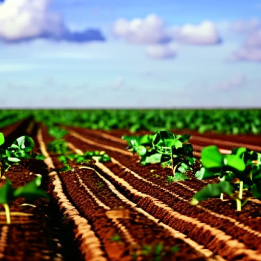
The agro-industrial farms of Mato Grosso in Brazil are known for their efficiency and ability to plant and harvest two crops per year due to abundant rainfall and a long rainy season. However, these farms are not without risks. Periodic droughts and the recent decline in mean annual precipitation, caused by climate change and deforestation, have affected crop cycles. The decline in rainfall has led to a delay in the onset of the rainy season, impacting the first and second harvests. This delay affects crops such as soy and maize, known as the “safrinha.”
The gradual decline in precipitation has increased the risk of poor maize yield. To mitigate this risk, some producers have adopted center-pivot irrigation systems. The number of these systems has grown significantly over the years. Precision water management through irrigation systems can increase yields during both crop cycles by ensuring optimum soil moisture at key stages of plant development. Some producers have even started planting a third crop.

Irrigation circles cover approximately 2% of the area under intensive cultivation in Mato Grosso. Most producers extract water directly from rivers or small impoundments. The expansion of irrigation systems has been most notable on the headwaters of the Teles Pires (Tapajós), Río das Mortes (Araguaia), Juruena (Tapajós), and Alto Xingu rivers.
Regulation of irrigation systems in Mato Grosso is overseen by the state environmental authority Secretaria de Estado de Meio Ambiente do Mato Grosso (SEMA), in coordination with the state water council (Conselho Estadual de Recursos Hídricos de Mato Grosso – CEHIDRO) and basin-specific governance committees. Current guidelines limit surface water removals to 70% of minimum waterflows and restrict individual stakeholders from taking more than twenty percent of that total. While current extraction levels comply with these guidelines, the ongoing expansion of irrigation systems at a rate of ten percent per year will eventually exceed surface water supplies. This will lead to increased reliance on groundwater resources, particularly the Parecis Aquifer.
The national water agency (Agência Nacional de Águas e Saneamento Básico – ANA) used information on surface and groundwater resources to develop the Atlas Irrigação, a national planning document that maps the nation’s irrigation potential. According to the atlas, Mato Grosso has the water resources necessary to irrigate 3.9 million hectares of cropland, which is approximately 40% of the total area under cultivation in 2020. This irrigation would partially compensate for the decline in rainfall caused by deforestation but could disrupt waterflows and impact biodiversity and ecosystem function in the upper Tapajós, Xingu, and Araguaia watersheds.
Yes, the following indicators can be used to measure progress towards the identified targets:
Behold! This splendid article springs forth from the wellspring of knowledge, shaped by a wondrous proprietary AI technology that delved into a vast ocean of data, illuminating the path towards the Sustainable Development Goals. Remember that all rights are reserved by SDG Investors LLC, empowering us to champion progress together.
Source: news.mongabay.com
Join us, as fellow seekers of change, on a transformative journey at https://sdgtalks.ai/welcome, where you can become a member and actively contribute to shaping a brighter future.
 SDGs, Targets, and Indicators
1. Which SDGs are addressed or connected to the issues highlighted in the article?
2. What specific targets under those SDGs can be identified based on the article’s content?
3. Are there any indicators mentioned or implied in the article that can be used to measure progress towards the identified targets?
Table: SDGs, Targets, and Indicators
SDGs
Targets
Indicators
SDG 6: Clean Water and Sanitation
Target 6.4: By 2030, substantially increase water-use efficiency across all sectors and ensure sustainable withdrawals and supply of freshwater to address water scarcity.
Indicator 6.4.1: Change in water-use efficiency over time.
SDG 13: Climate Action
Target 13.1: Strengthen resilience and adaptive capacity to climate-related hazards and natural disasters in all countries.
Indicator 13.1.1: Number of deaths, missing persons, and directly affected persons attributed to disasters per 100,000 population.
SDG 15: Life on Land
Target 15.1: By 2020, ensure the conservation, restoration, and sustainable use of terrestrial and inland freshwater ecosystems and their services, in particular forests, wetlands, mountains, and drylands, in line with obligations under international agreements.
Indicator 15.1.1: Forest area as a proportion of total land area.
![]()


