Satellite-based tool in development by MSU researchers takes guesswork out of soil sampling
Satellite-based tool in development by MSU researchers takes ... Mississippi State University


Contact: Meg Henderson
Introduction
Mississippi State University (MSU) is one of 12 academic institutions that have received a $300,000 grant from the National Institute of Food and Agriculture. The grant, totaling $9 million, aims to develop projects that contribute to the maintenance or improvement of soil productivity, environmental health, and sustainability. MSU’s research team is working on the development of a high-tech tool called the Satellite-based Soil Sampling Design (S3DTool) to assist farmers worldwide in maintaining healthy soils.
The S3DTool
The S3DTool is an automated soil sampler that utilizes a deep learning algorithm to extract information from historic satellite image data. This tool provides farmers with field-wide information from multiple points in time, helping them make informed decisions about soil sampling. By analyzing satellite images of the canopy, the S3DTool can calculate crop growth, which serves as an indicator of soil health. The goal is to provide feedback on the soil of an entire field, taking into account its variabilities.
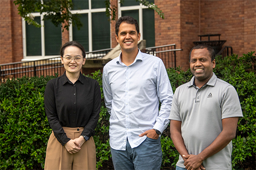
Research Team
The research team at MSU consists of three assistant professors from the Department of Agricultural and Biological Engineering: principal investigator Vitor S. Martins and co-investigators Nuwan Wijewardane and Xin Zhang. These scientists are affiliated with the Mississippi Agricultural and Forestry Experiment Station. The team is also supported by postdoctoral fellow Lucas Ferreira.
Challenges of Soil Sampling
Regular soil sampling is crucial for maintaining healthy and productive agricultural fields. However, this practice can be time-consuming and expensive, especially for small and medium-sized farms. Additionally, sampling at a limited number of locations may not accurately represent the entire field, as soil properties can vary widely. The S3DTool aims to address these challenges by providing targeted data for efficient soil management.
Mapping and Testing
The research team’s first step is to map out the boundary of their test site at MSU’s R.R. Foil Plant Science Research Center using artificial intelligence technology. They then compile high-quality satellite images from the past decade or two and use AI machine learning techniques to identify optimal geographic locations for soil testing. Finally, they conduct manual soil tests in the areas pinpointed by the S3DTool to confirm the accuracy of its data.
Sustainable Development Goals
The development of the S3DTool aligns with several Sustainable Development Goals (SDGs), including:
- SDG 2: Zero Hunger – By improving soil health and productivity, the S3DTool contributes to ensuring food security and promoting sustainable agriculture.
- SDG 13: Climate Action – Healthy soils play a crucial role in mitigating climate change by sequestering carbon and reducing greenhouse gas emissions.
- SDG 15: Life on Land – The S3DTool helps maintain the health and biodiversity of terrestrial ecosystems by supporting sustainable land management practices.
Future Implications
If successful, the S3DTool has the potential to be used by farmers worldwide, providing them with targeted data to manage healthy crop fields. The research team aims to expand their model nationally and globally, contributing to sustainable agriculture practices on a larger scale.
Conclusion
The development of the S3DTool by Mississippi State University’s research team is a significant step towards maintaining healthy soils and promoting sustainable agriculture. By leveraging satellite image data and artificial intelligence, this high-tech tool has the potential to revolutionize soil sampling practices and support farmers in making informed decisions about soil management.
Contact Information
To learn more about MSU’s Department of Agricultural and Biological Engineering, visit www.abe.msstate.edu.
Visit the Mississippi Agricultural and Forestry Experiment Station at www.mafes.msstate.edu.
Mississippi State University is taking care of what matters. Learn more at www.msstate.edu.
SDGs, Targets, and Indicators
-
SDG 2: Zero Hunger
- Target 2.4: By 2030, ensure sustainable food production systems and implement resilient agricultural practices that increase productivity and production, that help maintain ecosystems, that strengthen capacity for adaptation to climate change, extreme weather, drought, flooding, and other disasters, and that progressively improve land and soil quality.
- Indicator 2.4.1: Proportion of agricultural area under productive and sustainable agriculture.
- Indicator 2.4.2: Proportion of total agricultural population with ownership or secure rights over agricultural land, by sex; and Indicator 2.4.3: Average income of small-scale food producers, by sex and indigenous status.
-
SDG 15: Life on Land
- Target 15.3: By 2030, combat desertification, restore degraded land and soil, including land affected by desertification, drought and floods, and strive to achieve a land degradation-neutral world.
- Indicator 15.3.1: Proportion of land that is degraded over total land area.
- Indicator 15.3.2: Proportion of important sites for terrestrial and freshwater biodiversity that are covered by protected areas, by ecosystem type.
Table: SDGs, Targets, and Indicators
| SDGs | Targets | Indicators |
|---|---|---|
| SDG 2: Zero Hunger | Target 2.4: By 2030, ensure sustainable food production systems and implement resilient agricultural practices that increase productivity and production, that help maintain ecosystems, that strengthen capacity for adaptation to climate change, extreme weather, drought, flooding, and other disasters, and that progressively improve land and soil quality. | Indicator 2.4.1: Proportion of agricultural area under productive and sustainable agriculture.
Indicator 2.4.2: Proportion of total agricultural population with ownership or secure rights over agricultural land, by sex. Indicator 2.4.3: Average income of small-scale food producers, by sex and indigenous status. |
| SDG 15: Life on Land | Target 15.3: By 2030, combat desertification, restore degraded land and soil, including land affected by desertification, drought and floods, and strive to achieve a land degradation-neutral world. | Indicator 15.3.1: Proportion of land that is degraded over total land area.
Indicator 15.3.2: Proportion of important sites for terrestrial and freshwater biodiversity that are covered by protected areas, by ecosystem type. |
Analysis
-
SDG 2: Zero Hunger
The article addresses the issue of maintaining healthy soils for agricultural productivity, which is directly connected to SDG 2: Zero Hunger. By developing a high-tech tool to aid farmers in maintaining or improving soil productivity, the article contributes to the goal of ensuring sustainable food production systems and implementing resilient agricultural practices.
Specific Target: Target 2.4: By 2030, ensure sustainable food production systems and implement resilient agricultural practices that increase productivity and production, that help maintain ecosystems, that strengthen capacity for adaptation to climate change, extreme weather, drought, flooding, and other disasters, and that progressively improve land and soil quality.
Indicators:
- Indicator 2.4.1: Proportion of agricultural area under productive and sustainable agriculture.
- Indicator 2.4.2: Proportion of total agricultural population with ownership or secure rights over agricultural land, by sex.
- Indicator 2.4.3: Average income of small-scale food producers, by sex and indigenous status.
-
SDG 15: Life on Land
The article also addresses the issue of soil degradation and the need to restore degraded land and soil. This is connected to SDG 15: Life on Land, which aims to combat desertification, restore degraded land and soil, and achieve a land degradation-neutral world.
Specific Target: Target 15.3: By 2030, combat desertification, restore degraded land and soil, including land affected by desertification, drought and floods, and strive to achieve a land degradation-neutral world.
Indicators:
- Indicator 15.3.1: Proportion of land that is degraded over total land area.
- Indicator 15.3.2: Proportion of important sites for terrestrial and freshwater biodiversity that are covered by protected areas, by ecosystem type.
Behold! This splendid article springs forth from the wellspring of knowledge, shaped by a wondrous proprietary AI technology that delved into a vast ocean of data, illuminating the path towards the Sustainable Development Goals. Remember that all rights are reserved by SDG Investors LLC, empowering us to champion progress together.
Source: msstate.edu
![]()
Join us, as fellow seekers of change, on a transformative journey at https://sdgtalks.ai/welcome, where you can become a member and actively contribute to shaping a brighter future.


