Buried deep freshwater reserves beneath salinity-stressed coastal Bangladesh – Nature

Executive Summary
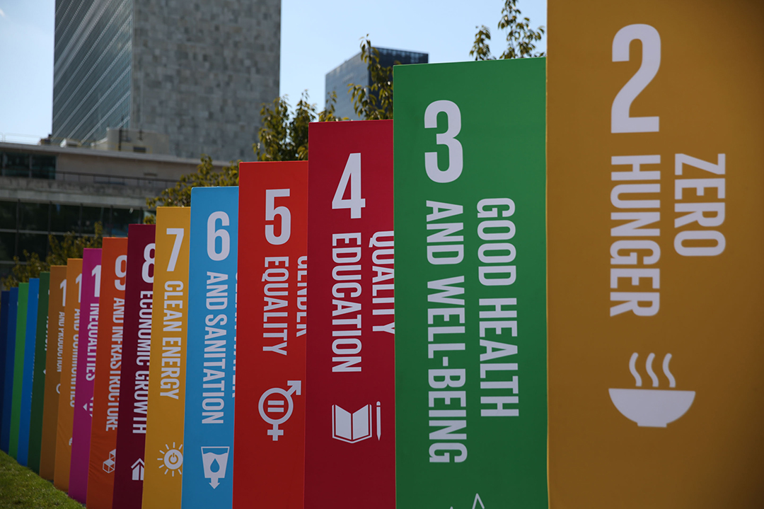
A geophysical investigation in the coastal region of the Ganges-Brahmaputra Delta, Bangladesh, was conducted to address critical freshwater shortages, a challenge central to achieving Sustainable Development Goal 6 (SDG 6: Clean Water and Sanitation). The region faces a multifaceted water crisis from aquifer overexploitation, saltwater intrusion, and arsenic contamination, severely limiting access to safe drinking water and impacting community health (SDG 3) and agricultural productivity (SDG 2). Using deep-sensing magnetotelluric soundings, this study mapped subsurface electrical resistivity to distinguish between fresh and saline groundwater. The investigation revealed two significant deep freshwater aquifers, likely formed during the Last Glacial Maximum. These vital resources are separated by a high-salinity zone attributed to the Ganges paleovalley incision. The findings provide a crucial hydrogeological framework for developing sustainable water management strategies, directly supporting the resilience of coastal communities (SDG 11) and offering a model for identifying similar resources in other water-stressed deltas globally.
1.0 Introduction: Addressing Water Scarcity in Coastal Bangladesh
1.1 The Regional Water Crisis and its Impact on Sustainable Development
Freshwater scarcity in coastal regions presents a significant barrier to sustainable development. In southwestern Bangladesh, this challenge is intensified by a combination of environmental and anthropogenic pressures, directly undermining progress toward several Sustainable Development Goals (SDGs).
- Saltwater Intrusion: Rising sea levels, exacerbated by climate change (SDG 13), and local practices such as shrimp farming have led to widespread saline intrusion into shallow groundwater systems.
- Pollution: Shallow aquifers, where accessible, are frequently contaminated with arsenic and other pollutants, posing a severe risk to public health and well-being (SDG 3).
- Resource Pressure: High population density places immense strain on limited freshwater resources, affecting water availability for drinking, sanitation, and agriculture, which are fundamental to alleviating poverty (SDG 1) and ensuring food security (SDG 2).
The urgent need to identify new, safe, and sustainable freshwater sources is paramount for building resilient communities (SDG 11) in the region.
1.2 Study Objective: Mapping Deep Groundwater to Support SDG 6
While deep groundwater (>150 m) is recognized as a potential source of low-salinity, arsenic-free water, its extent and the hydrogeological processes governing its distribution are poorly understood. This study aims to delineate the deep freshwater resources in coastal Bangladesh to provide a scientific basis for their sustainable management. The primary objective is to map the spatial distribution of fresh and saline groundwater, thereby contributing directly to Target 6.1 of the SDGs: achieving universal and equitable access to safe and affordable drinking water for all.
2.0 Methodology: Geophysical Imaging of Subsurface Aquifers
2.1 Magnetotelluric (MT) Survey Design
To image deep groundwater systems, a non-invasive geophysical method, broadband magnetotelluric (MT) soundings, was employed. This technique is highly effective for mapping contrasts in electrical resistivity, which are primarily controlled by pore fluid salinity.
- A 120 km-long MT transect was established along the Pusur River, from the urban center of Khulna City to the coastline at the Sundarbans mangrove forest.
- Data were collected at 25 sites with an average spacing of 5 km to capture the large-scale hydrogeological structure.
- The method measures natural variations in the Earth’s electric and magnetic fields to determine subsurface resistivity from near-surface depths to several kilometers.
2.2 Data Inversion and Salinity Estimation
The collected MT data were processed and inverted to create a 2D electrical resistivity model of the subsurface. This model was subsequently used to estimate groundwater salinity. Bulk resistivity values were converted to pore fluid salinity using Archie’s law, incorporating parameters such as sediment porosity, temperature, and pressure. This conversion provides a quantitative assessment of freshwater reserves, essential for water resource planning and management in line with SDG 6.
3.0 Key Findings: Deep Freshwater Reserves and Controlling Geological Structures
3.1 Delineation of Deep Aquifers and a Saline Gap
The resistivity model revealed a complex subsurface hydrogeological system characterized by distinct zones of fresh and saline water.
- Freshwater Aquifer R1: A prominent, deep freshwater body located in the northern part of the transect, extending down to 800 m. This aquifer represents a substantial potential resource for the region.
- Freshwater Aquifer R2: A second, shallower freshwater body located within the central Sundarbans, reaching a depth of 250 m. This finding is critical for understanding water availability for the vital mangrove ecosystem (SDG 14 and SDG 15).
- Saline Gap C1: A 20 km-wide high-salinity zone separating the two freshwater aquifers. This feature corresponds geographically with the incised Ganges paleovalley.
3.2 Geological Controls on Freshwater Distribution
The distribution of these deep water resources is governed by geological processes linked to past sea-level cycles, which has significant implications for their long-term sustainability.
- Formation during Low Sea Level: The freshwater aquifers (R1 and R2) are interpreted as having formed during the Last Glacial Maximum (LGM), when a lower sea level exposed the continental shelf to freshwater recharge.
- Preservation by Protective Layers: The aquifers are sealed by overlying fine-grained, low-permeability sediments deposited during the subsequent marine transgression. This natural protection is crucial for safeguarding the water quality from surface contamination and salinization.
- Role of Paleovalleys: The saline gap (C1) was created when the incised Ganges paleovalley was infilled with marine sediments during the Holocene sea-level rise. This structure acts as a barrier between the freshwater bodies and a potential conduit for saltwater intrusion.
4.0 Implications for Sustainable Water Management and the SDGs
4.1 A Pathway to Achieving SDG 6 (Clean Water and Sanitation)
The identification of these deep, low-salinity, and likely arsenic-free aquifers provides a tangible opportunity to address the regional water crisis. These findings offer a strategic guide for locating future extraction wells to supply safe drinking water, thereby reducing reliance on contaminated shallow sources. However, the slow recharge rates of these paleowaters necessitate careful management to ensure their long-term sustainability and avoid depletion, aligning with SDG Target 6.4 on sustainable water use.
4.2 Supporting Community Resilience and Economic Stability
Access to a reliable source of clean water is a cornerstone for sustainable communities (SDG 11). By providing an alternative to saline and contaminated water, these deep aquifers can support:
- Public Health (SDG 3): Reducing exposure to waterborne diseases and arsenic poisoning.
- Food Security (SDG 2): Offering a potential source for sustainable irrigation, mitigating the impacts of salinity on agriculture.
- Poverty Reduction (SDG 1): Enhancing livelihood security by ensuring a fundamental resource for health and economic activity is available.
4.3 Enhancing Climate Adaptation and Ecosystem Protection
This study underscores the interplay between past climate cycles and current resource availability. Understanding this system is vital for developing effective climate adaptation strategies (SDG 13). The presence of a freshwater aquifer (R2) within the Sundarbans highlights the need for integrated management that considers the water requirements of this critical ecosystem (SDG 15), which serves as a natural barrier against climate-related hazards like storm surges.
5.0 Conclusion
This investigation successfully mapped two previously uncharted deep freshwater reserves in coastal Bangladesh, providing critical insights into their formation and geological context. The findings demonstrate that the interplay of Pleistocene sea-level fluctuations and subsequent sedimentation patterns has created significant, albeit non-renewable, freshwater resources. This knowledge is fundamental for developing strategic, long-term water management plans that align with the Sustainable Development Goals, particularly SDG 6. The hydrogeological framework established in this study not only offers a solution for the water-stressed population of coastal Bangladesh but also serves as a valuable model for exploring and managing deep groundwater resources in other major deltas worldwide facing similar challenges.
Analysis of Sustainable Development Goals in the Article
1. Which SDGs are addressed or connected to the issues highlighted in the article?
The article on freshwater resources in coastal Bangladesh addresses several interconnected Sustainable Development Goals (SDGs). The primary focus is on water security, but this extends to issues of health, climate resilience, and sustainable communities.
-
SDG 6: Clean Water and Sanitation
This is the most central SDG to the article. The entire study revolves around the challenges of freshwater availability and quality in coastal Bangladesh. The article explicitly discusses “freshwater scarcity,” “aquifer overexploitation,” “saltwater intrusion,” and contamination from “arsenic (As) and other pollutants,” all of which are core concerns of SDG 6.
-
SDG 3: Good Health and Well-being
The article directly connects water quality to public health by mentioning that “shallow aquifers are often contaminated with arsenic (As) and other pollutants.” Arsenic in drinking water is a major cause of illness and death, so identifying arsenic-free deep groundwater sources is crucial for improving health outcomes in the region.
-
SDG 13: Climate Action
The article establishes a clear link between climate change and the water crisis, stating that “Freshwater scarcity, exacerbated by climate change, is a severe problem in coastal regions.” It specifically identifies “Relative sea-level rise” as a factor that has “intensified saline intrusion,” highlighting the need for climate adaptation strategies, such as securing alternative water sources.
-
SDG 11: Sustainable Cities and Communities
The research is set in a region characterized by “high population density,” including Khulna City. Ensuring a sustainable and safe water supply is fundamental for the resilience and sustainability of such coastal communities. The study’s goal to “map potential resources for this water-stressed region” directly supports the development of more sustainable human settlements.
-
SDG 14: Life Below Water
The article discusses the coastal zone, the “fresh-to-saltwater transition zone,” and the impact of “saltwater intrusion.” It also mentions that shrimp farming, a coastal aquaculture practice, contributes to this intrusion. These issues highlight the delicate balance of coastal and marine ecosystems and the impact of land-based activities on them.
2. What specific targets under those SDGs can be identified based on the article’s content?
Based on the issues discussed, several specific SDG targets can be identified:
-
SDG 6: Clean Water and Sanitation
- Target 6.1: By 2030, achieve universal and equitable access to safe and affordable drinking water for all. The article’s primary objective is to address the lack of safe drinking water by identifying “new freshwater sources” that are low in salinity and arsenic, which are described as “vital water supplies.”
- Target 6.3: By 2030, improve water quality by reducing pollution… and substantially increasing recycling and safe reuse globally. The study focuses on improving water quality by locating deep aquifers that are free from the “arsenic (As) and other pollutants” and high salinity found in shallow groundwater.
- Target 6.4: By 2030, substantially increase water-use efficiency across all sectors and ensure sustainable withdrawals and supply of freshwater to address water scarcity. The article highlights the problems of “aquifer overexploitation” and “freshwater scarcity.” By mapping the dimensions of deep aquifers, the study provides essential data for developing “sustainable management strategies” and ensuring sustainable withdrawals.
- Target 6.5: By 2030, implement integrated water resources management at all levels. The geophysical mapping and hydrogeological analysis presented in the article are foundational components of integrated water resources management, providing a framework for understanding and managing the entire groundwater system.
-
SDG 3: Good Health and Well-being
- Target 3.9: By 2030, substantially reduce the number of deaths and illnesses from hazardous chemicals and air, water and soil pollution and contamination. The identification of deep, low-arsenic groundwater is a direct strategy to mitigate the health impacts of arsenic contamination, which is a major problem in the shallow aquifers of Bangladesh.
-
SDG 13: Climate Action
- Target 13.1: Strengthen resilience and adaptive capacity to climate-related hazards and natural disasters in all countries. The article frames the water crisis as being “exacerbated by climate change” and sea-level rise. Mapping deep, potentially climate-resilient freshwater reserves is a key action to strengthen the region’s adaptive capacity to the impacts of climate change on water resources.
-
SDG 11: Sustainable Cities and Communities
- Target 11.5: By 2030, significantly reduce the number of deaths and the number of people affected… by disasters, including water-related disasters. Chronic water scarcity and contamination, worsened by sea-level rise, can be considered a slow-onset, water-related disaster. Securing a stable water supply reduces the vulnerability of the population in this “water-stressed region.”
3. Are there any indicators mentioned or implied in the article that can be used to measure progress towards the identified targets?
The article mentions or implies several quantitative and qualitative indicators that can be used to measure progress towards the identified targets.
-
Indicators for SDG 6 (Clean Water and Sanitation)
- Groundwater Salinity Levels: The article explicitly measures and models salinity. It uses the Practical Salinity Scale (psu) and defines freshwater as being “
- Arsenic (As) Contamination Levels: The article repeatedly refers to arsenic contamination in shallow aquifers and the low-arsenic nature of deep groundwater. The concentration of arsenic in water sources is a key indicator of water safety (Target 6.1) and pollution (Target 6.3).
- Volume and Extent of Freshwater Aquifers: The study uses magnetotelluric soundings to “image the deep, large-scale aquifers” and understand their dimensions. This data provides a quantitative estimate of available freshwater resources, which is crucial for measuring the level of water stress (Indicator 6.4.2) and planning for sustainable supply (Target 6.4).
-
Indicators for SDG 3 (Good Health and Well-being)
- Proportion of Population Accessing Arsenic-Free Water: While not measured directly, the study’s goal of mapping low-arsenic deep aquifers implies this indicator. Progress could be measured by tracking the number of new wells drilled into these safe aquifers and the population they serve, directly addressing Target 3.9.
-
Indicators for SDG 13 (Climate Action)
- Availability of Climate-Resilient Water Sources: The deep aquifers identified in the study are described as being protected by overlying sediments and containing ancient (Pleistocene-age) water. Their isolation from modern, climate-affected surface processes makes them a resilient resource. The mapped volume of this resilient water source is an indicator of the region’s adaptive capacity (Target 13.1).
4. Create a table with three columns titled ‘SDGs, Targets and Indicators” to present the findings from analyzing the article.
| SDGs | Targets | Indicators |
|---|---|---|
| SDG 6: Clean Water and Sanitation |
6.1: Achieve universal and equitable access to safe and affordable drinking water.
6.3: Improve water quality by reducing pollution. 6.4: Increase water-use efficiency and ensure sustainable withdrawals to address water scarcity. |
– Groundwater salinity levels (measured in psu; freshwater defined as
– Concentration of arsenic (As) and other pollutants in groundwater. – Volume and spatial extent of identified deep freshwater aquifers (R1 and R2). – Level of water stress (implied by discussion of “aquifer overexploitation” and “freshwater scarcity”). |
| SDG 3: Good Health and Well-being | 3.9: Substantially reduce illnesses and deaths from hazardous chemicals and water pollution. |
– Presence and concentration of arsenic (As) in shallow aquifers. – Availability of low-arsenic deep groundwater as an alternative safe source. |
| SDG 13: Climate Action | 13.1: Strengthen resilience and adaptive capacity to climate-related hazards. |
– Rate of saltwater intrusion linked to sea-level rise. – Volume and extent of deep, protected aquifers as a climate-resilient water resource. |
| SDG 11: Sustainable Cities and Communities | 11.5: Reduce the number of people affected by water-related disasters. | – Identification of new freshwater sources to mitigate the impacts of water scarcity on a high-density population. |
| SDG 14: Life Below Water | 14.1: Prevent and significantly reduce marine pollution from land-based activities. | – Extent of saltwater intrusion into coastal aquifers, partly driven by land-based activities like shrimp farming. |
Source: nature.com
What is Your Reaction?
 Like
0
 Dislike
0
 Love
0
 Funny
0
 Angry
0
 Sad
0
Sad
0
 Wow
0
Wow
0


