


Extreme precipitation and flooding in Berlin under climate change and effects of selected grey and blue-green measures – Copernicus.org
Report on Urban Flood Resilience and Climate Change Adaptation
Introduction: The Imperative for Sustainable Urban Water Management
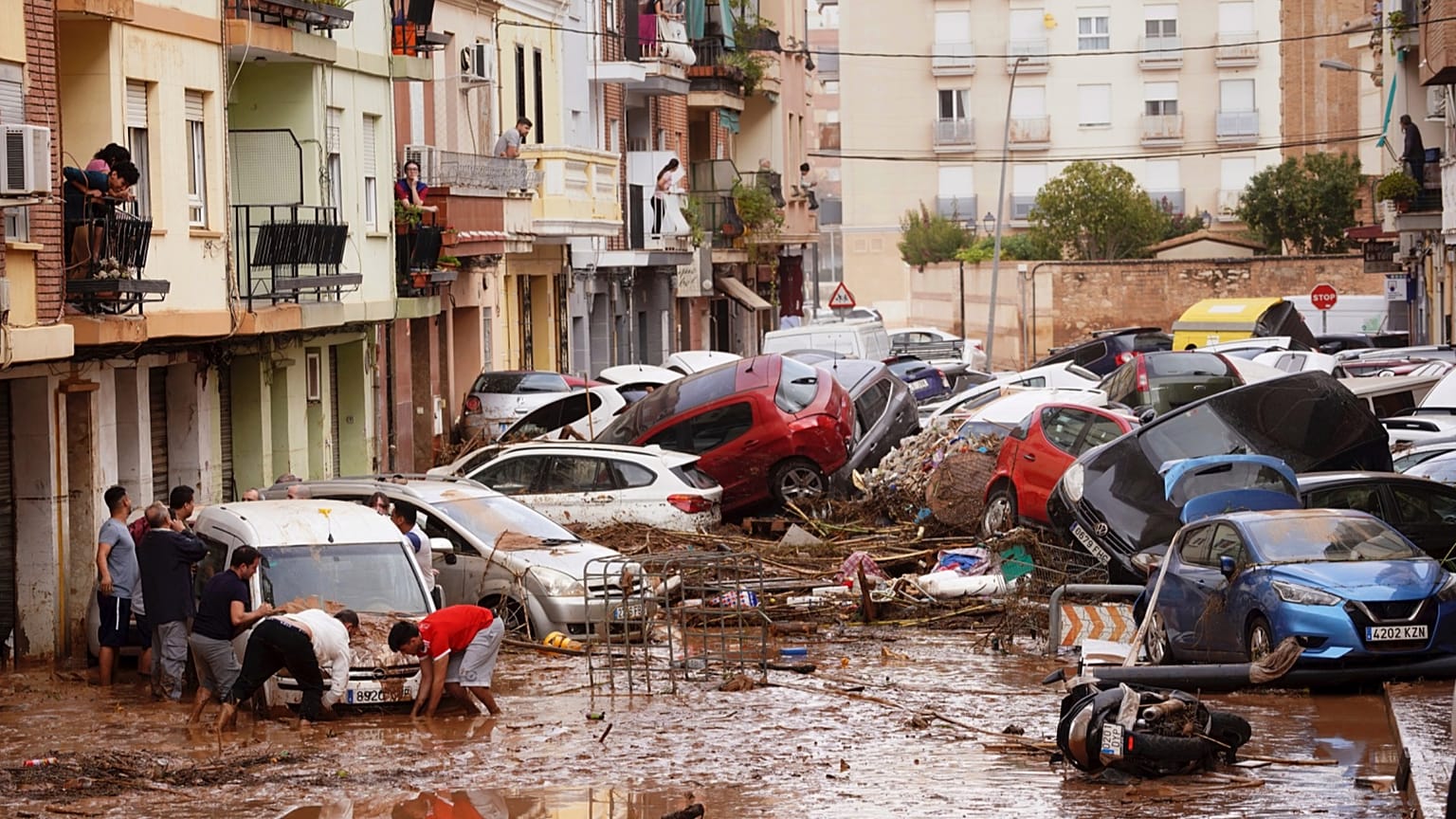
The increasing frequency and intensity of extreme precipitation events, driven by anthropogenic climate change, pose a significant threat to urban environments worldwide. This phenomenon, documented by the Intergovernmental Panel on Climate Change (IPCC, 2021; 2022) and various studies (Fowler et al., 2021), leads to a higher risk of pluvial flooding. Such events challenge existing urban infrastructure, endanger public safety, and can cause substantial economic damage. Addressing this challenge is not merely a matter of disaster management but is central to achieving global sustainability targets.
This report synthesizes findings and methodologies from recent research to outline a comprehensive framework for assessing and mitigating urban flood risk. The analysis is framed within the context of the United Nations Sustainable Development Goals (SDGs), with a particular focus on:
- SDG 11 (Sustainable Cities and Communities): Enhancing the safety and resilience of urban settlements against climate-related hazards.
- SDG 13 (Climate Action): Strengthening adaptive capacity and integrating climate change measures into national and local policies and planning.
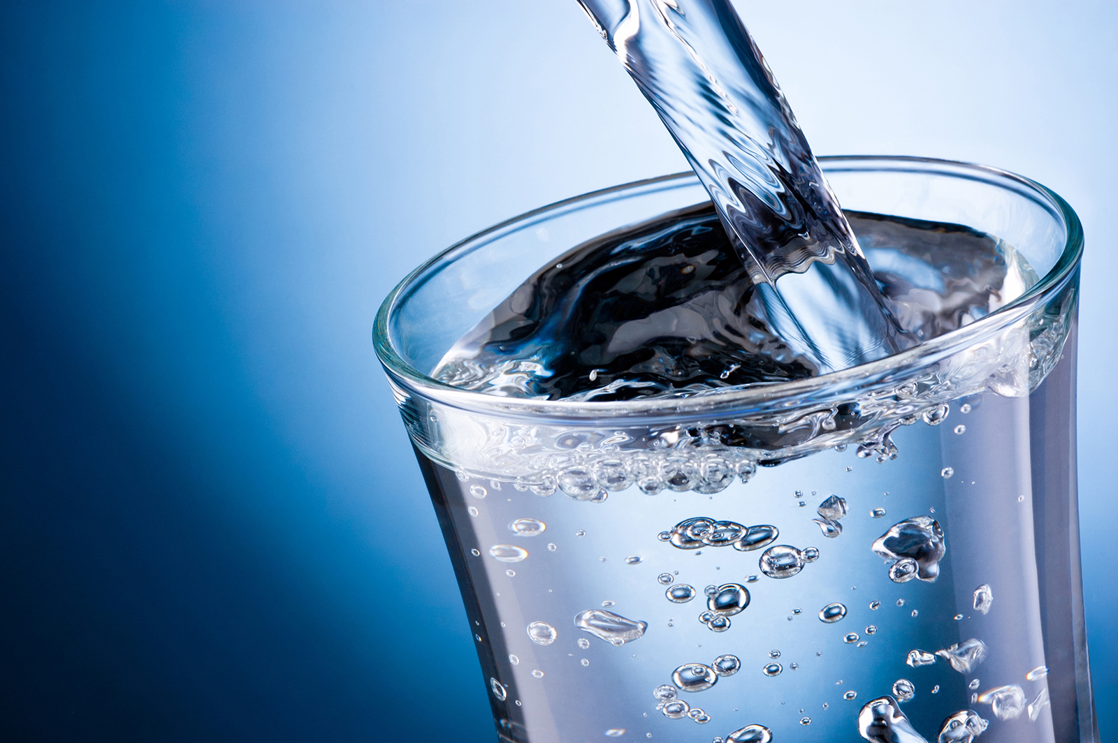
- SDG 6 (Clean Water and Sanitation): Improving integrated water resources management, including stormwater.
- SDG 9 (Industry, Innovation, and Infrastructure): Building resilient infrastructure through advanced modeling and technological solutions.
Methodological Framework for Flood Risk Assessment
Data-Driven Urban Analysis
A robust assessment of urban flood risk relies on the integration of high-resolution geospatial and climatological data. The foundation for accurate modeling includes several key datasets, particularly demonstrated in studies concerning German municipalities like Berlin:
- Topographical Data: Digital Elevation Models (e.g., ATKIS® DGM Berlin) are essential for simulating surface water flow paths.
- Land Use and Infrastructure Data: Information on buildings, land use (Geoportal Berlin, 2024a; 2024b), and soil sealing (Umweltatlas Berlin, 2022) determines surface runoff characteristics.
- Hydrological Properties: Data on soil permeability (Umweltatlas Berlin, 2019; 2024) is critical for modeling infiltration processes.
- Climatological Records: Historical and projected precipitation data from national weather services (Deutscher Wetterdienst, 2025) and statistical products like KOSTRA (2020) provide the basis for defining rainfall scenarios.
The systematic collection and application of this data directly support SDG 11 by enabling evidence-based urban planning and risk management.
Advanced Hydrodynamic and Climate Modeling
To translate climate data into actionable flood risk information, advanced simulation tools are employed. The process involves a chain of models:
- Climate Projections: Convection-permitting regional climate models, such as COSMO-CLM (Haller et al., 2022a; 2022b; Rybka et al., 2023), provide high-resolution future precipitation scenarios that capture the dynamics of extreme convective storms.
- Hydrological and Hydrodynamic Models: Tools like the Storm Water Management Model (SWMM) (Rossman and Huber, 2015) and 2D surface flow models like RIM2D (Apel et al., 2024) and hms++ (Steffen and Hinkelmann, 2023) simulate the entire rainfall-runoff-inundation process, from drainage system capacity to overland flooding.
This application of innovative technology aligns with SDG 9 by fostering the development and use of resilient infrastructure and sophisticated engineering solutions.
Climate Change Impacts on Urban Hydrology
Intensification of Extreme Rainfall and Flood Hazards
A consensus in climate science indicates a significant anthropogenic intensification of short-duration, extreme rainfall events (Fowler et al., 2021; Hundhausen et al., 2024). These changes render historical rainfall statistics, often used for designing urban drainage systems (DWA, 2006), increasingly obsolete. Studies project that the intensity of extreme precipitation will continue to rise, placing unprecedented pressure on urban water infrastructure (Li et al., 2024).
The direct consequence is an elevated risk of pluvial flooding, which can endanger critical infrastructure and human life. Research on pedestrian stability in floodwaters highlights the direct safety risks associated with even moderate inundation depths (Martínez-Gomariz et al., 2016). Hazard maps, such as those developed by the German Federal Agency for Cartography and Geodesy (BKG, 2021; 2025), are vital tools for communicating this risk to the public and policymakers.
Implications for SDG 13: Climate Action
The detailed analysis of future climate impacts on local precipitation patterns is a cornerstone of effective climate action (SDG 13). By quantifying the expected increase in extreme rainfall, municipalities can move from reactive disaster response to proactive adaptation. This research provides the scientific basis required to develop and implement robust, long-term adaptation strategies, fulfilling the core objective of integrating climate resilience into urban development policies as mandated by the EU Floods Directive (EUR-Lex, 2007).
Strategies for Enhancing Urban Flood Resilience
Nature-Based Solutions and Low Impact Development (LID)
Modern stormwater management is shifting away from purely gray infrastructure (pipes and channels) towards integrated approaches that utilize natural processes. These strategies, often referred to as Low Impact Development (LID), “Sponge Cities,” or Nature-Based Solutions (NBS), aim to manage rainwater where it falls.
- Increasing Infiltration: Reducing sealed surfaces and creating green spaces, permeable pavements, and infiltration trenches helps recharge groundwater and reduces runoff volume (Neumann et al., 2024).
- Decentralized Retention: Green roofs, rain gardens, and retention basins can store water temporarily, reducing the peak load on drainage systems (Hua et al., 2020).
These approaches, as explored in the “Sponge City” concept (Zevenbergen et al., 2018), offer co-benefits such as improving biodiversity, mitigating urban heat island effects, and enhancing public amenity spaces.
Contribution to SDG 11: Sustainable Cities and Communities
The implementation of LID and NBS is a direct contribution to making cities and human settlements inclusive, safe, resilient, and sustainable (SDG 11). By reducing flood risk, these strategies protect housing and critical infrastructure (Target 11.1 and 11.5). Furthermore, by creating multifunctional green infrastructure, they enhance the quality of the urban environment and promote the well-being of residents, aligning with the broader vision of sustainable urban development.
Conclusion: Integrating Research and Policy for a Sustainable Future
The challenge of urban pluvial flooding in a changing climate requires an integrated, multi-disciplinary approach. High-resolution data, advanced climate and hydrodynamic models, and innovative water management strategies are all essential components of a comprehensive solution. Collaborative research projects, such as AMAREX, InnoMAUS, and NUKLEUS in Germany, exemplify the necessary partnership between academia, government, and industry to translate scientific knowledge into practical applications.
By proactively assessing climate-related risks and investing in resilient, nature-based infrastructure, cities can significantly enhance their adaptive capacity. This forward-looking approach is fundamental to achieving the Sustainable Development Goals, ensuring that urban areas can thrive as safe, resilient, and sustainable hubs for future generations.
1. Which SDGs are addressed or connected to the issues highlighted in the article?
-
SDG 11: Sustainable Cities and Communities
- The article’s references focus heavily on urban environments, specifically addressing issues like “urban inundation simulation,” “urban flooding reduction strategies,” and flood risk in cities like Berlin (“ATKIS® DGM Berlin,” “Geoportal Berlin”). This directly relates to making cities and human settlements inclusive, safe, resilient, and sustainable.
-
SDG 13: Climate Action
- Numerous citations link extreme weather events to climate change. References such as “How will climate change impact Berlin?,” “Anthropogenic intensification of short-duration rainfall extremes,” and “Climate change signals of extreme precipitation” show a clear connection to taking urgent action to combat climate change and its impacts. The use of climate models (“COSMO-CLM5-0-16”) and IPCC reports further solidifies this link.
-
SDG 6: Clean Water and Sanitation
- The article addresses the management of water-related disasters through its focus on “Stormwater Drainage Networks,” “urban drainage pressure,” and pluvial flooding. Concepts like “Sponge Cities” also point towards sustainable water management, which is a core component of SDG 6.
-
SDG 9: Industry, Innovation, and Infrastructure
- The discussion revolves around the resilience of urban infrastructure, particularly “Stormwater Drainage Networks,” to extreme weather. Furthermore, the article is built upon scientific research and innovation, citing numerous advanced hydrodynamic and climate models (“RIM2D,” “hms++”), simulation techniques, and data platforms (“Geoportal Berlin,” “Deutscher Wetterdienst (DWD)”) used to assess and improve infrastructure resilience.
2. What specific targets under those SDGs can be identified based on the article’s content?
-
Target 11.5: Reduce the number of deaths, affected people, and economic losses from disasters, including water-related disasters.
- The core theme of the referenced literature is the assessment and mitigation of urban pluvial flooding. Works on “fast urban inundation simulation for flood risk assessment,” “flash flood simulations,” and the creation of heavy rain hazard maps (“Hinweiskarte Starkregengefahren”) are all aimed at understanding and reducing the impact of water-related disasters on urban populations and economies.
-
Target 11.b: Increase the number of cities implementing integrated policies and plans for climate change adaptation and disaster resilience.
- The article references strategies and tools that support integrated planning. The mention of “Sponge Cities,” “low impact development,” and the development of city-specific hazard maps (“Umweltatlas Berlin: Starkregen- und Überflutungsgefahren”) implies a move towards holistic disaster risk management and climate adaptation plans at the city level.
-
Target 13.1: Strengthen resilience and adaptive capacity to climate-related hazards and natural disasters.
- The research cited, such as “Climate change signals of extreme precipitation return levels for Germany” and “Assessing urban drainage pressure and impacts of future climate change,” is fundamental to understanding future risks and building adaptive capacity. The entire collection of works aims to improve how cities can withstand and respond to climate-related hazards like extreme rainfall.
-
Target 9.1: Develop quality, reliable, sustainable and resilient infrastructure.
- The article’s focus on the “Hydraulische Bemessung und Nachweis von Entwässerungssystemen” (Hydraulic dimensioning and verification of drainage systems) and the modeling of stormwater networks directly addresses the need to ensure that critical infrastructure is resilient to the increasing pressures of climate change-induced heavy rainfall.
3. Are there any indicators mentioned or implied in the article that can be used to measure progress towards the identified targets?
-
Implied Indicators for Flood Risk and Impact (Target 11.5)
- Flood Hazard Maps: The reference to “Hinweiskarte Starkregengefahren” (Heavy Rain Hazard Information Map) and “Starkregen- und Überflutungsgefahren” (Heavy Rain and Flood Hazards) implies the use of maps showing areas at risk, which is a key indicator of risk assessment progress.
- Simulated Inundation Depth and Extent: Models like “RIM2D” for “urban inundation simulation” produce data on the potential depth and area of flooding. This data serves as a direct measure of physical risk to urban areas.
-
Implied Indicators for Climate Adaptation and Resilience (Target 13.1 & 11.b)
- Intensity-Duration-Frequency (IDF) Curves: The mention of research on “intensity–duration–frequency curves” under climate change indicates the use of updated meteorological statistics. The development and application of these curves are indicators of a city’s capacity to adapt its infrastructure planning to future climate conditions.
- Climate Projection Data: The use of data from climate models like “COSMO-CLM” to project future precipitation extremes is an indicator of advanced planning and the integration of climate science into disaster risk reduction strategies.
-
Implied Indicators for Infrastructure Performance (Target 9.1)
- Hydraulic Performance of Drainage Systems: The article cites works on “Hydraulische Bemessung und Nachweis von Entwässerungssystemen” and assessing “urban drainage pressure.” The results of these assessments (e.g., capacity, overflow frequency) are direct indicators of infrastructure resilience.
- Effectiveness of Mitigation Strategies: Research on “evaluating the effect of urban flooding reduction strategies” and the “Potential of Decentral Nature-Based Solutions” implies the use of metrics to measure how effective these interventions are, such as reduction in flooded area or peak runoff.
4. Create a table with three columns titled ‘SDGs, Targets and Indicators” to present the findings from analyzing the article.
| SDGs | Targets | Indicators (Implied from the Article) |
|---|---|---|
| SDG 11: Sustainable Cities and Communities | 11.5: Reduce losses from water-related disasters.
11.b: Implement integrated policies for disaster resilience. |
|
| SDG 13: Climate Action | 13.1: Strengthen resilience and adaptive capacity to climate-related hazards. |
|
| SDG 9: Industry, Innovation, and Infrastructure | 9.1: Develop quality, reliable, sustainable and resilient infrastructure. |
|
| SDG 6: Clean Water and Sanitation | 6.5: Implement integrated water resources management. |
|
Source: nhess.copernicus.org
What is Your Reaction?
 Like
0
Like
0
 Dislike
0
Dislike
0
 Love
0
Love
0
 Funny
0
Funny
0
 Angry
0
Angry
0
 Sad
0
Sad
0
 Wow
0
Wow
0